Showing posts with label Tsukuba. Show all posts

Sunday, March 15, 2015

WCDRR day 2

World Conference on Disaster Risk Reduction in Sendai - day 2

Today I visited 4 sessions, the first three at the Sendai international conference building and the last at Tohoku University, located on a beautiful hill side, at Hagi hall (presentations will follow). The hagi tree is the symbol of the university.
My main question during the presentation of the Global Assessment Report 2015 was how the work of the GAR differs from ICHARM's goal to make a risk index. The main points include ICHARM's focus on flood hazards, end point indicators of governance and resilience of communities, and the national level and cooperation with national governments in creating and applying the index data.

Wednesday, September 10, 2014

Symposium "Policy studies on huge disasters"

Hosted at GRIPS, this symposium featured two keynote speeches by experts and a panel discussion with the following members:

  • Mr. Tetsuro Ito (Guest Professor, The University of Tokyo, Former Chief Cabinet Secretary for Crisis Management)
  • Mr. Takahito Iwata  (Director of Emergency Management Department, Shizuoka Prefectural Government)
  • Mr. Hajime Kagiya   (General Manager of Secretariat to the Assembly, Itabashi Ward Tokyo, Lecturer of Hosei University)
  • Prof. Keiko Tamura (Professor, Risk Management Office at Niigata University, Former member of Central Disaster Prevention Council)
  • Prof. Haruo Hayashi (Keynote speech 1 “Huge disasters and Improvement of resilience”)(Professor and Director, Research Center for Disaster Reduction Systems, Disaster Prevention Research Institute Kyoto University)
  • Prof. Naoshi Hirata (Keynote speech 2 “Generating mechanism of the huge earthquake disasters”) (Professor and Director, Earthquake Prediction Research Center at The University of Tokyo)

While the speeches were mainly technical and focused on the GEJET 2011 and predictions of similar future events in other areas of Japan, the panel discussion allowed for a small widening of topics, most importantly because it was possible to hand in questions to the panel members. There were simultaneous English-Japanese translations, so the following information may contain translation errors.

During the speeches the current predictions of a magnitude 8-9 earthquake in the Nankai trough (South East Japan) in the coming 30 years has 60-70% chance of occurring and showed over 300,000 deaths and a 30m tsunami in Shikoku. It is expected to cost 420 billion yen to reduce the estimated victims.


Tokyo still has a high probability of a magnitude 7+ earthquake. Here the main cause of death in projections is estimated to occur by electrical fires (70% of all projected deaths), meaning policies are focusing on how to stimulate private house owners to improve their houses as the government taxes are not sufficient to pay for all individual improvements. The fires are predicted to last 2 days as firefighters won't be able to reach all locations and electricity is thought to be out for one week. No police or ambulance can travel on the road for about a month due to obstructions. The Tokyo population is still increasing, not to births which are actually less than the amount of deaths, but due to immigration.

Equally interesting was the predictions of a magnitude 7-8 earthquake in Hokkaido and more northern island, which are Russian. Here it was mentioned that for some disputed islands, it is legally unclear who is responsible to save the inhabitants, though of course the Japanese government would make any effort to save those in need of rescue regardless of nationality.

During the panel discussion several topics were brushed. Mr. Iwata explained about Shizuoka, which already has many communities of 25% older adults where communities may lose their functions and become isolated during a disaster due to the mountainous area and easily blocked roads. It may even be that the area cannot receive relief. Should the communities aim at being fully self-resilient or be interdependent?

Residents who refused to evacuate when ordered to do so during the GEJET came in two categories, as explained by Prof. Tamura. The first wanted to claim damages, thought they understood the water level, and didn't acknowledge the tsunami. This could be addressed with by more education and adaptability. The second just couldn't pull themselves away from daily life, due to e.g. medication. This also requires more education during the normal routine, think about how you can be comfortable evacuating, and by keeping precious belonging nearby and ready to take with you.

Prof. Hirata commented on the possible eruption of mount Fuji, which was met with laughter. He said explosions are never sudden, there are several predicting phenomenon observed before eruptions. Some of those signs can be detected, and there are none right now. The magazine and press reports are without substance. During a magnitude 5 earthquake there were volcanic eruptions, so there will be a slightly higher chance for Fuji to erupt during a magnitude 9 earthquake. It could occur in the coming 50 years, a hazard map is available.
Mr. Iwata added that there is an evacuation plan coordinated between 3 prefectures which will be rehearsed next month and focuses on pyroclastic flow. One difficultly for the Nankai trough earthquake is that several eruptions are expected, roads will be damaged, and a small flow will already result in 200,000 evacuees, which is very difficult to manage.

Mr. Ito commented on local disaster drills. Always the same people visit the drills, but they would like to train specifically young mothers and students. There are not enough people to organize workshops on the community level. He also said that having a nice plan with pictures does not mean implementation is easy. For individuals, he recommends to make a disaster plan beforehand with your family based on the assumption that you are still alive and the shelters work. You should have water and food, and be fully prepared to protect yourself.

Mr. Ito also mentioned the relocation of (governmental functions of) Tokyo, which has been discussed many times and abandoned for various reasons. Can the ministries in Kasumigaseki survive? How can this, and the stock exchange, be maintained? Do the backup offices function? These questions remained unanswered.

All in all it was a highly educational discussion with comments from experts in all policy levels as well as from various parts of the country, each adding their valuable experiences.

Saturday, March 29, 2014

ICHARM covered on BBC

The BBC covered ICHARM research and held interviews with several researchers in their article "Can a Zen-like approach help countries with floods?"

Interviewees include Kazuhiko Fukami from the NILIM across the street, and from ICHARM Minoru Kamoto and my main supervisor and director, Kuniyoshi Takeuchi, who is quoted to say: "The disaster impact is increasing so much, this has nothing to do with climate change, it is a change of society".
As my own thesis points out, it is the increase of populations in areas exposed to hazards, in combination with an increase of vulnerable population percentages that lead to the increase of disaster impacts. This is happening regardless of climate change induced increases in intensity and frequency of hazards. Governments have to decide the economic tipping point and value of lives by either favoring safer locations and building codes over continuous investments and uncontrolled urbanization of areas exposed to hazards.

Wednesday, December 4, 2013

New map of Japan by GSI

The Geographical Survey Institute has released a new online interactive map of Japan.

What's interactive about it? Outside of the regular maps with volcanoes and historical pictures, they have added many layers of additional information. For instance, you can select the category 'disaster prevention' and view the crustal deformation from the GEJET per prefecture. It shows Tsukuba's ground surface subsided about 10 cm.
Areas in Aomori, Akita and Yamagata were raised about 3-10 cm, whereas the entire East coast from Iwate to Chiba experienced some amount of subsidence. The highest figure is -114 cm, on the coast line Northeast of Sendai city. All in all, a great map for scientific reference.

Tuesday, November 19, 2013

Deep earthquake

A very deep earthquake occurred last night, at a depth of some 350 km. Probably due to fault lines not being vertical, the quake was felt to be the strongest some 350 km Eastward, resulting in the below awkward map from JMA:


It was only shindou 2, so we could continue our sleep.

Wednesday, October 16, 2013

Do you know where your nearest earthquake proof shelter in Tsukuba is?

In follow up to the last post about earthquake proof shelters, here is some additional information.

I have prepared a google earth file showing all the locations of the shelters mentioned in the the table provided by Tsukuba city hall. First find the shelter closest to your house. Then use the table to determine whether or not the shelter is earthquake proof. This is denoted by o (yes) or x (no) in the column marked 耐震性の判定.

You can also find the construction year in Japanese years (s for showa emperor period, h for heisei) in the column marked  建築年. You can see that from showa 57, or 1982, the building code changed from old to new. It is not clear what the difference is between the old and new building codes from this table.

But why not also find the shelter closest to your work, or along the road to work? Please also remember if you have to go to a(n earthquake proof) shelter, there might not be sufficient facilities. You should always bring your own medication or additional items in case of e.g. pregnancy, and take in mind that the shelter might not be able to house your pet(s). Prepare a bag with items to bring to the shelter today, so you are not caught unprepared during the stressful period of a severe earthquake.

Earthquake proof shelters in Tsukuba

In response to the news that only 56% of all evacuation shelters in Japan are earthquake proof, I asked the Tsukuba city hall which evacuation centers in Tsukuba were earthquake proof. I was sent an abundance of information, mainly in Japanese. The website provides among others an overview of each shelter (school) and the earthquake proof status.

They further explained:
Mainly primary and junior high schools are designated as the evacuation shelters.
The designated 16 primary schools, 15 junior schools, 16 kindergartens, the day care centers, the children’s halls and the social welfare centers are all checked for earthquake resistance. Some of the buildings which were not strong enough for earthquakes have been already strengthened or scheduled to be strengthened by the 2015 fiscal year. Please note that the schools as evacuation centers are controlled and maintained by each school.

So in 1.5 years at least in Tsukuba all the shelters will be compliant to the standards of earthquake proof buildings. I asked the assistance of a Japanese co-worker in translating the information and finding an actual 100% earthquake proof shelter (if such a thing is possible), near my house, so we wouldn't end up going to a not-or less earthquake proof shelter. The ensuing conversation proves I am in Japan.

Co-worker: "You know, the earthquake may not happen for a long time."
Me: "Or it could happen today. It is the 'statistical reality'."
Co-worker, after a dramatic silence: "...I have lived long enough..."

(At this point I'm disturbing other people as I cry out what a horrible thing it is to say...)

Let's not forget the news from 1.5 years ago: "The earthquake research institute at Tokyo University said that in the worst case, a quake of magnitude 7 would hit the southern part of metropolitan Tokyo by 2016, while the chances of a similar disaster occurring within 30 years are as high as 98%. The government, by contrast, estimates the possibility of an earthquake that size striking the capital at 70% in the next three decades."

I'm still trying to find out any scientific arguments why the government prefers to have a 30% chance of no earthquake over 2%.

Original news article from the Yomiuri Shimbun, October 11 2013:
Only about half of the designated evacuation sites in 44 prefectures are quake-resistant, according to a survey conducted by the Board of Audit. Out of the 90,262 shelters designated by 1,615 municipalities, 50,964, or 56.5 percent, could adequately withstand earthquakes, the board said Wednesday. The survey did not cover Iwate, Miyagi and Fukushima prefectures.
The survey has brought to the fore questions regarding the resistance of evacuation centers, as about 44 percent of them are not well prepared for secondary damage caused by aftershocks. Yet many people are expected to stay at such shelters if there is a massive quake, such as a Nankai Trough earthquake or a quake directly under the metropolitan area. Public facilities such as school buildings and community centers are designated as evacuation centers based on a regional disaster prevention plan mapped out by each municipal government.

The board, which received a request from the Diet to inspect the antiquake measures implemented at such shelters, conducted an oral survey of the local governments. The rate of earthquake-proofed school buildings has increased to 85.5 percent. The Education, Culture, Sports, Science and Technology Ministry aims to complete reinforcing the school buildings against earthquakes by fiscal 2015.

However, reinforcement against seismic activities at other evacuation shelters such as community centers and assembly halls has not made much progress. In this area, the quake-proofing rate remained at less than 60 percent. By municipalities, 73.8 percent of shelters in ordinance-designated cities, 57.5 percent in other cities and wards and 49.3 percent in towns and villages are resistant to seismic shocks. The results show that towns and villages are far behind in taking measures compared to urban districts.

Meanwhile, among 1,615 municipalities, only 37.2 percent, or 600, have mapped out a manual on how to operate an evacuation center, such as what kind of arrangements for daily life should be made there. While 94.7 percent of ordinance-designated cities have drawn up their own manuals, only 21 percent of towns and villages have done so.


After the Great East Japan Earthquake in March 2011, hygiene problems in such places as restroom facilities and supply shortages cropped up at many shelters. The Cabinet Office, which has held meetings to improve the living environment at evacuation centers since October last year, compiled a report in March asking local governments to create manuals, set up guidelines to operate evacuation centers and explain how they plan to cope with issues that may occur at the shelters.


Sunday, October 6, 2013

Tsukuba city disaster drill 2013

While I always wanted to research how an emergency drill would function for people with disabilities, I had to forego this chance exactly because of the disability.

Tsukuba city had its annual disaster drill this Sunday. Due to typhoon 22, it was raining earlier that week on Wednesday morning, when I optimistically rushed outside in my rain suit. I went down the stairs faster than expected as I had slipped half way through, falling on my hand and back. I merrily avoided a scaphoid fracture. However in combination with the program I started to follow this month on Saturdays in Tokyo, it proved to be too much to also visit the drill this year. So instead, here is a movie of me in action last year.

Information:

Disaster Drill for Foreigners of Tsukuba
Disaster Drill will be provided for foreign residents.
Date & Time: Sunday, 6 October 8:30 - 12:00
Location: The entrance of the City Hall
Language: There will be interpreters for some languages.
Applicants: 30 people
Application: Apply by calling ore e-mail before the event.
Contact: Tsukuba International Association
phone:029-869-7675
            e-mail: ohki@inter.or.jp

Thank you and we hope the drill will give you good hints.


Monday, September 9, 2013

Another small pheasant warning

Again I was cycling through the fields when the pheasants, and even a lone crow, started crying. It did not last very long and seemed less panicked than the previous time. I saw no obvious effects of an earthquake, but with last week fresh in mind, upon arriving at work I checked the JMA records to find that indeed, another small earthquake had occurred. I am seriously considering pheasants as an early warning system, or to check whether other animals with less obnoxious mating calls can perform the same.


Wednesday, September 4, 2013

Another earthquake warning by pheasants

This morning there was an earthquake. I did not notice it myself, but the pheasants did. I was on my bicycle out in the fields when it occured.

It is not their mating season, so I was highly surprised to hear them cry out in panic for as long as they did. Unlike the previous earthquake where I heard them scream (December 7, 2012), this was a very long lasting screaming, for well over a minute. I immediately checked the power lines for swaying, but there was nothing out of the ordinary. Being a rainy day, there were no farmers out in the fields or other people walking around to verify if they were experiencing an earthquake. I thought it must be something else that had startled them. I was wrong.


There had been an earthquake, magnitude 6.9, but only shindou 3 in our area. Apparently it was very long lasting, coming from such a depth (400 km). The pheasants have proved accurate earthquake alarms once again, even if shindou 3 is not noticeable on a bicycle.


Wednesday, May 15, 2013

Radiation and recovery

The reconstruction agency was brought into life to speed the recovery from the Great East Japan Earthquake and Tsunami (GEJET) of March 11, 2011.

The Japanese government has made great efforts in establishing strict safety standards. These have become stricter over time. For instance, in April 2012 the standards for radioactive cesium were adapted (See http://www.mhlw.go.jp/english/topics/2011eq/dl/new_standard.pdf) and now the safety standards for drinking water have become the same as that of the World Health Organization, being 10 Bq/kg. (Note that from this text it is unclear which radioactive cesium is meant, but it may be cesium-137 with a half-life of just over 30 years, and not cesium-134 with a half-life of just over 2 years, as cesium-137 is often described as radioactive cesium.) These new standards have at the very least restored the faith of foreign governments in accepting Japanese food as commercial trade products. Recent research in Nature shows that radioactive freshwater fish however are spreading across Japan.

Regarding the decontamination process, two things are striking. First of all, there are many areas in the provinces surrounding Fukushima that are designated as Intensive Contamination Survey Areas, including Tsukuba. A closer look at the safety limits for additional radiation shows that it is 0.23 micro Sieverts/hour, or over 1 milli Sievert/year. This is well below standards in European capitals and less than the average X-ray scan or airplane trip. One of the available radiation maps shows Tsukuba is well within the limits of 2 milli Sievert/year, or 228.3 nano Sievert/hour. Fukushima obviously is not, with levels of  1410 milli Sievert/year or 161000 nano Sievert/hour at the nuclear power plant, and 254 milli Sievert/year or 28962 nano Sievert/hour at neighboring town Okuma. Even at a measuring point 1 km from Fukushima town station, on of the Tohoku Shinkansen (bullet train) stops, 350 nano Sievert/hour is measured today, corresponding to a level of  just over 3 milli Sievert/year. More information can be found here.

Second of all is the optimistic presentation of the Interim Storage Facility, which places radioactively contaminated soil and other materials in plastic bags and covers it in soil in available spaces. What this website does not show is how this policy turns out in practice, as can be seen in an NHK documentary. Due to objections from local citizens based on fear and uncertainty, and lack of government decisions on future storage locations, some people are now sacrificing their own back yard for temporary storage. The National Institute for Environmental Studies in Tsukuba is one of the organizations tasked with recovery and cleanup of the contaminated materials. At last year's open day, I asked one of the experts of NIES what fail mechanisms were in place to ensure such storage facilities were not disrupted by earthquakes and consequent leaking to ground water, but this was not met with enthusiasm at that time. It remains unclear and unlikely given the small amount of available space that fault lines are taken into consideration when selecting areas for temporary waste storage.

Issues yet to be addressed by the government are made more clear in the NHK documentary as well. Discrimination and bullying due to misinformation and fears, as well as lack of social networks and support when relocating parts of families are severely disrupting people's lives every day. Providing more information aimed at children as well as adults, and securing livelihoods in safe areas for entire families are crucial for rebuilding people's lives.

Friday, December 7, 2012

Earthquake

It's been a while. As all of such earthquakes are described, before this one some smaller ones occurred, leading up to the bigger one. No problems whatsoever, except the elevator stopping. Currently anticipating aftershocks.

I was just cycling home, later than usual, in the dark, with a new 100 yen shop light. Pheasants were crying out in the agricultural field next to me, which was extremely uncommon. All of them at once, as if they were in a great panic. However, a truck wanted to pass me in the dark, so I paid it no mind, and turned a corner. They had stopped crying. The houses next to me however, started to rattle. Extremely loud. Only then did I notice the earthquake. It was so intense I decided it was better to stop cycling. Past the houses, on the opposite side of the road where the power lines weren't swinging and dancing.

It was only shindou 4 in Tsukuba. Shindou 4 is described as "People outside can notice the tremor" Today I learned it means "Nearly fall off bicycle even after stopping". After a minute of moving up and down from primary waves, the secondary waves came. Distant city lights remained on, so I figured it was best to continue homewards and see what was up. Only 3 things had toppled over from a shelf. 10 out of 12 free access tv channels are showing tsunami warnings.

JMA posted a tsunami warning:
***********About Tsunami Forecast************

Tsunami height is expected to be up to 2 meters. Caution advised.

Tsunami height is expected to be about 0.5 meters. Attention advised.

******* Earthquake Information ********
 Occurred at 17:18 JST 07 Dec 2012
 Region name SANRIKU OKI
 Latitude37.8N
 Longitude144.2E
 Depth about 10 km
 Magnitude 7.3

NHK TV channel says 'people must evacuate' in those areas, in different languages, repeating every 3 minutes. I'm guessing all tsunami by now have already reached the shore. Several towns are reporting observed tsunami heights. Some flights are delayed due to inspection of the runway. There are no real issues. All that is left is to hope this isn't followed by a magnitude 9 earthquake in three days...

Sunday, November 11, 2012

Ninomiya House Drill

Ninomiya House organized its own fire safety drill, which was very exciting. It was combined with tips on earthquake safety, as earthquakes are also a likely cause of fire. The whole two hours were packed with activities.

First all people had to evacuate the building using stairs and safety exits, wearing protective helmets. We had to gather at a rendezvous park close-by, at which point everyone was accounted for per floor. Next was a fire fighting drill with lo and behold actual fires. The extinguishers contained water though, but the spray cans for kitchen fires seemed the real deal. The fire department showed how everything should be worked, and volunteers were actively sought to replicate each of the demonstrated actions.


"Fire!" This is the most important thing to do before actual fire fighting. Call out to your neighbors and make sure they hear you, then head in with the right equipment. Useful information was also given. As I expected, if the ceiling is on fire, run. Smoke kills 90% of people in fires, so always cover your mouth and stay low.
We were also taught how to activate emergency power generators, in case the power would fail on the weekend, and few staff would be available to help. Firetruck ladders can reach up to 40 meters, so escaping to a balcony would not be a problem. The water from the hoses however, came only about 3 stories.


Afterwards at the lecture we unexpectedly got to taste some emergency supplies. Ninomiya House has food and water available for all residents for 5 days! Now we can start to eat our own supply.


Wednesday, October 31, 2012

Field Trip to GSI and NIED

Today we visited the Geospatial Information Authority of Japan (still going by its old acronym of Geographical Survey Institute) and the National Research Institute for Earth Science and Disaster Prevention

Having visited the GSI twice already, I had yet to experience any information in English. We received two lectures on the activities relating to disasters and a short guided tour, including of course a 3D view of Japan. New maps included an overview of all the stops of the JR line from Ushiku to Tokyo, passing by Nagareyama and showing the channel we visited earlier this month. This time I managed to find GRIPS on the current and old maps of Tokyo, as well as Hibiya park and Tokyo station.


A big highlight at NIED was the ability to make more accurate rainfall predictions than the JMA, as they use ground based radars (including mobile ones). The second impressive feature was visiting the large scale rainfall simulator. Installed in the ceiling of this mobile building are four types of water sprouts, capable of simulating up to 200 mm per hour rainfall, which was of course demonstrated. There will be an open day in April with a typhoon and earthquake simulator as well, so I am eager to return here. 


Wednesday, October 10, 2012

Field Trip to Urban Renaissance Agency

The day after Sports Day, we visited the flood management structures in Tsukuba with the new master students. This year we have 12 new students, and 1 new PhD student (so far).

The development agency responsible for the Western area of Tsukuba around station number 19 of the TX, Kenkyugakuen or Katsuragi, has a very interesting name. There is in fact nothing renaissance about the agency, and the project only becomes urban after development. However, the speed of development is impressive, considering eight different sites along the TX were developed in total. The entire project at Tsukuba was scheduled to house 25,000 people and run from 2000 to 2018, but already 70% of the development is completed.
Due to the presence of the Hasunuma river, a tributary of Yada river that flows into Ushiku lake in the South, a number of measures were taken for flood management. These included 2 regulating ponds (permanently filled with water, in the West) and 3 retarding basins (only temporarily filled with water, in the East). The retarding basins have special inlets as well as outlets, which can be seen on the photos. The new housing areas have separate rainwater sewerage, and the houses have gutters connected to this system. Parks and parking spaces have permeable areas also connected to this sewerage. It was nice to see these systems so close to home.


Monday, October 1, 2012

Tsukuba City Disaster Drill

Tsukuba City is very progressive in its disaster drills, in that it specifically invites foreigners to join actively in the drill and provides interpreters for them as well. Of course we joined, and we even ended up on the local television broadcast.

Around 30 foreigners were invited to sign up in total. After gathering at the City Hall entrance where we were greeted by interpreters, 5 people were asked to be active volunteers during the drill. The area behind City Hall, also used for fireworks festivals and other events, is actually the scheduled disaster practice area. The edges of the terrain were littered with tents and fold-able chairs for participants to relax, whether they were the fire brigade or local families. On one side information tents had been set up as well. The center proved most interesting with 3 houses and a pile of wood. Enough space was left  between the center and the tents for the longest emergency vehicles to drive around.
The program was fully packed and after the mandatory greetings, the first demonstration was debris removal.  Next was emergency hospital set up, with active involvement. Our group was called in to carry a dummy to an emergency site for revival by medical specialists, and ACCS was filming the whole setup.
Then a very exciting activity took place, as the search dogs from three different prefectures, Tokyo, Chiba and Ibaraki, were trained to find people inside a pretend collapsed house. After all three dogs confirmed the locations, the rescue team responded by cutting the house open and calling out to the 'victims' inside. If you are removed by the roof, you get extracted vertically! As soon as the people were brought to safety, the rescue team removed the house. This is to clear the imaginary streets of collapsed houses.
Around this time people got served emergency food and water, which was quite nice given the outside temperatures. 6 of the 35 sponsors included food companies or supermarkets. The cooperation with local food suppliers was very interesting. Next up was fixing gas, electricity and water supply lines.
Another drill to actively participate in was firefighting. One house fire was to be put out with a bucket line, whereas foreigners were given fire extinguishers for a second house. It was nice to practice with a real fire and real extinguisher for once, as most companies prefer to have water filled containers spraying at plasticized pictures of fire. We obtained a disaster prevention bag with a thermal blanket and other useful items.
At the information stands, we watched the simulated effects of liquefaction swallow a windmill and observed the power tools the military used to clear the streets after the Great East Japan Earthquake and Tsunami. Meanwhile, the roof of the city hall was being used as a helicopter drill site. We also took a look inside the mobile disaster unit, which had everything from a toilet to a fax machine, just in case city hall had to be abandoned. We can only hope more cities have such an active disaster prevention force, and interpreters as well.


Tuesday, May 8, 2012

Hojo Town Tornado Aftermath

Colleagues have taken pictures of the aftermath of the tornado in Hojo Town, at the North of Tsukuba municipality. The destruction is enormous. Below are images showing where Hojo town is in Japan, and a view of the tornado path. It still is hard to believe this is the same place we visited just three weeks back. Many former possessions are already stacked away as trash, and people are fixing their roofs. The Self Defense Force was also assessing damage. Even stone statues of the temples are broken and concrete power lines pushed into the ground.


Tsukuba City Homepage now also had information available in English:


There was a Tornado in Tsukuba City on May 6th (12:45pm)(Updated May 7,2012)
  • Evacuation Places
    1) Oda elementary school
    2) Tai elementary school
  • Where to dispose waste,rubbles, garbage, etc.
    1) Tsukuba community center (South parking area)
    ■8:30am - 17:15pm (every day for the time being)
    • wood/timber, heat insulating material, concrete walls, roof tiles are acceptable.
    2) Clean center
    ■weekdays 8:30am - 16:30pm, Sat 8:30am - 11:30am
    • burnable garbage, non-burnable garbage, home electric appliances are acceptable.
※Please bring the garbage directly to the Clean Center (Tsukuba Mimori 2339, Tel:029-867-1379)
  • Traffic Information
    Bus stops have changed around the Hojo area and around the Tsukuba community center.

The Japanese version of the website shows much more detailed information, including the following table (translated by Google Translate):

Human suffering (human)   Dwelling damage (buildings)
Dead
Missing person
Injured
Hojo district
Daisuna district Nishigoya district 
Yoshinuma district
Serious injuryMinor injury
 One
Zero Zero 37
170 destroyed, 207 partially destroyed, 450 damaged part, a total of 827
(Some of them are also included non-residential buildings such as warehouses, barns)

Almost immediately after the event the emergency volunteer website started to organize volunteer activities (translated by Google Translate):
We will begin registering volunteers to affected areas at this time a tornado occurred in Tsukuba City on May 6. Future, you will be asked to go to activity according to the needs of subscribers from the victims. Asked to perform activities according to your needs, so you may not be able to ask their activities are registered, please understand. Contact Volunteer Center disaster ◆ Tsukuba   Address: (place of study painting two school district town D32) 2530-2 Karima Tsukuba       , Tsukuba City Hall second floor   Phone :029 -883 -1370 ※ Registration time volunteers, 9:00 to 17:00 will be.  Addition, if you know of anyone who made ​​the request of the volunteer activities in Shakyo, we will join the (plan A natural disaster) insurance Shakyo volunteer activities at their own expense.  In addition, households are limited to local areas and, unlike when the earthquake affected areas, many are not coming up still needs volunteers. In addition, the site is located at inconvenient traffic, crowded with a vehicle such as debris removal and restoration work, and had been suffering from traffic congestion. Volunteer coordination, so you will be a request from more activity in accordance with the circumstances and needs of victims of the disaster area, familiar with regional conditions, please register it understands.

The JMA is being cautious and have issued a warning, according to the mainichiThe weather agency cautioned that similar atmospheric conditions that gave rise to the tornados on Sunday could develop over a wide area between Thursday through Friday. 
Let's take care riding our bicycles to work.

More scientific information can be found here.

Sunday, May 6, 2012

Trip to Kokai and Kinu river

We are safe!

Today we returned from a trip to the Kokai and Kinu river. The news when we returned was that Tsukuba had been struck by a tornado. It actually struck the Hojo area North of Tsukuba, where we visited with professor Takeuchi earlier last month. It also caused a power outage, but we have full power here, so it's almost as if nothing happened. The Tsukuba city website is displaying which bus to take to evacuation centers in case you were living in the Hojo area. Over 400 houses are destroyed and 30 people are injured, some severely, and one boy has died. Tornadoes are rare, it is said.

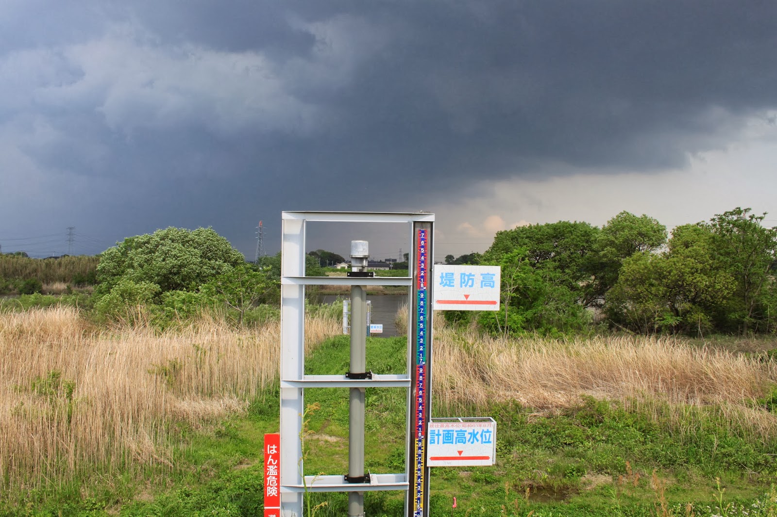
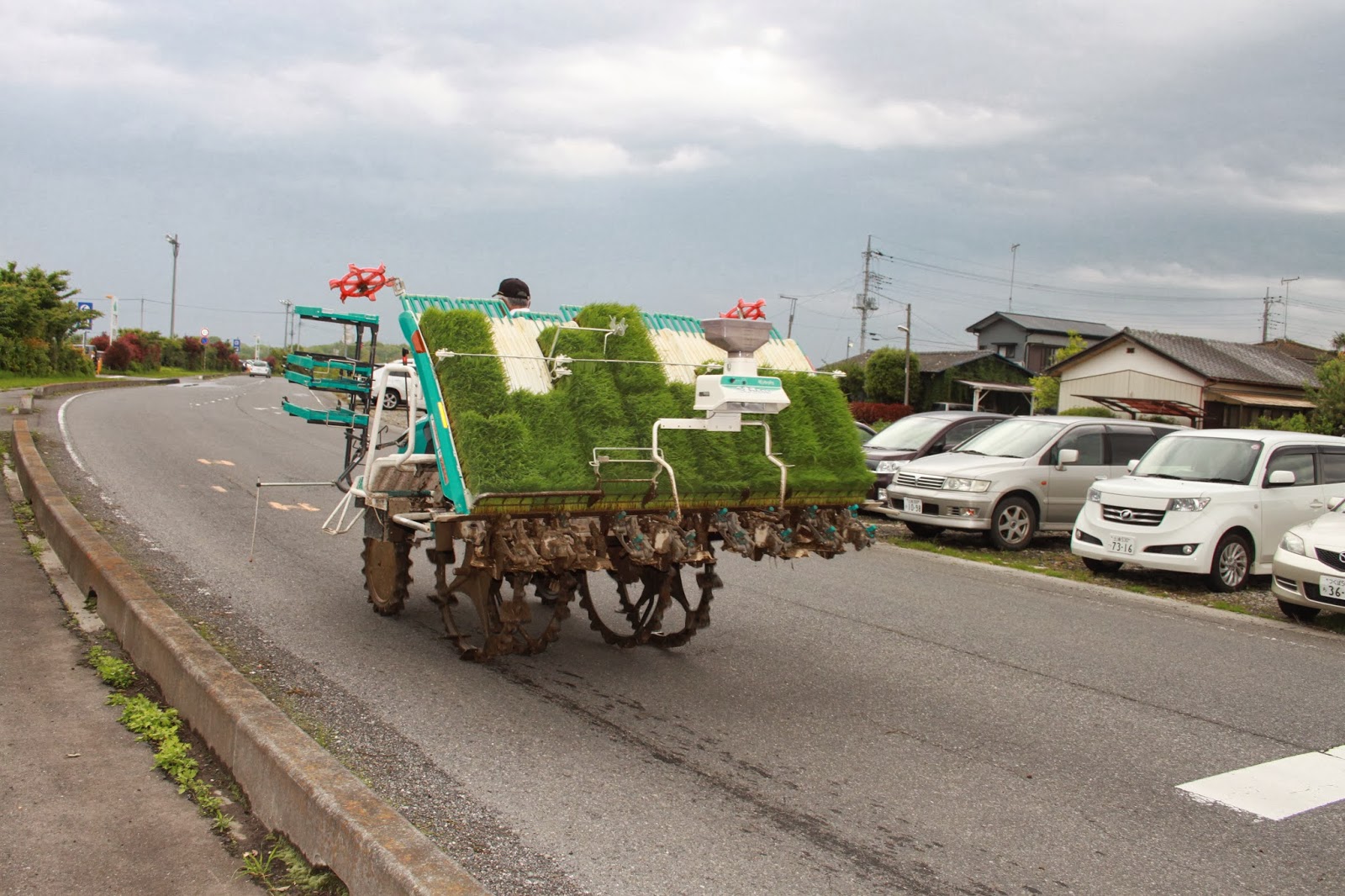
The pictures we took today show stormy skies. Having a holiday, many people were out on the river with jet skis or fishing equipment. At the Fukuoka weir, we nearly were blown off the weir into the water. This was about the time the tornado struck. We stopped at several water in- and outlets going North along the Kokai river. We ended up at the butterfly shaped insect museum, which also features fish and a gallery with pictures and images made from flower petals. At the Aeon shopping mall we saw an agricultural rice planting machine. The next day I heard there was a tornado in Tsuchiura last year, just 10 km South of Tsukuba. It doesn't sound quite so rare.


Sunday, April 15, 2012

Field Trip to Upper Sakura River Basin

Today we went on a trip with Takeuchi-sensei along the Northern part of the Sakura river. We saw Tsukuba mountain's Hojo ooike (big pond), visited the Amabikikannon and fed the peacocks, and went to the origin of the Sakura river as well as the Isobe Inamura jinja, which is the origin of Noh theater in this region and guards different Sakura tree species.

Hojo is a town in the North of the Tsukuba municipality, just South of its own little mountain. The Sakura river has not had many floods, but in 1986 the vicinity was affected. Hojo harbors these lakes mainly for fishing and irrigation rather than flood prevention, but it still helps. A little more upstream we encountered the same bridge we crossed when cycling to mount Tsukuba, and the inflatable dam. As opposed to the Netherlands, this dam is deflated during the flood season, and inflated to aid in, again, irrigation of the rice paddies. I was not so confident as professor Takeuchi, especially after noticing the air coming out of the dam suspiciously close to the drop point of the fishermen's hooks...


Our next stop was the Amabikikannon temple. Although the main theme of blessings here may be children and pregnancies, the name refers to pulling the water out of the sky (once more, for the harvest). The final temple, Sakuragawa Isobe Inamura Jinja, is said to be the origin of Noh theater in this region and is actually built around a stage where No was performed. It was possible to get a cleansing blessing while No theater music was playing. There is a total of 11 different sakura trees protected at this shrine, making it the best place for hanami. The differences between the trees can be very subtle or plain to see: different bark or petal colors or shapes, the amount of petals, fading color towards the end of the petals, one stamen transformed into a petal shape... it was definitely worthwhile to see all these differences. Here, we were fortunate enough to meet an employee of Sakuragawa city. He enthusiastically explained all our questions on floods in the Sakura river. He was even kind enough to guide us to the origin of the Sakura river. Nearby the shrine were an old Tsubaki tree and a holy pond, the poor water quality clarifying the issue of the untouchability of holy grounds.


Saturday, March 17, 2012

Field Trip to Chuugoku and Kinki region - day 4

Kobe is a very long and stretched city, squeezed between the Northern mountains and the Southern harbors. I could see across the bay to Osaka and other parts of Honshu island. The Jica building was next door to the earthquake disaster prevention center. It was tragic to learn that since the Kobe earthquake in 1995, even though many houses were refurbished and reinforced, if a similar earthquake would strike nowadays there would still not be enough evacuation centers to take care of all the evacuees, wounded or not. The National Seismic Hazard Map pointed out that Tsukuba is just in a higher risk area; however it's dated 2009. The center also featured informative and playful ways to demonstrate the effects of earthquakes.


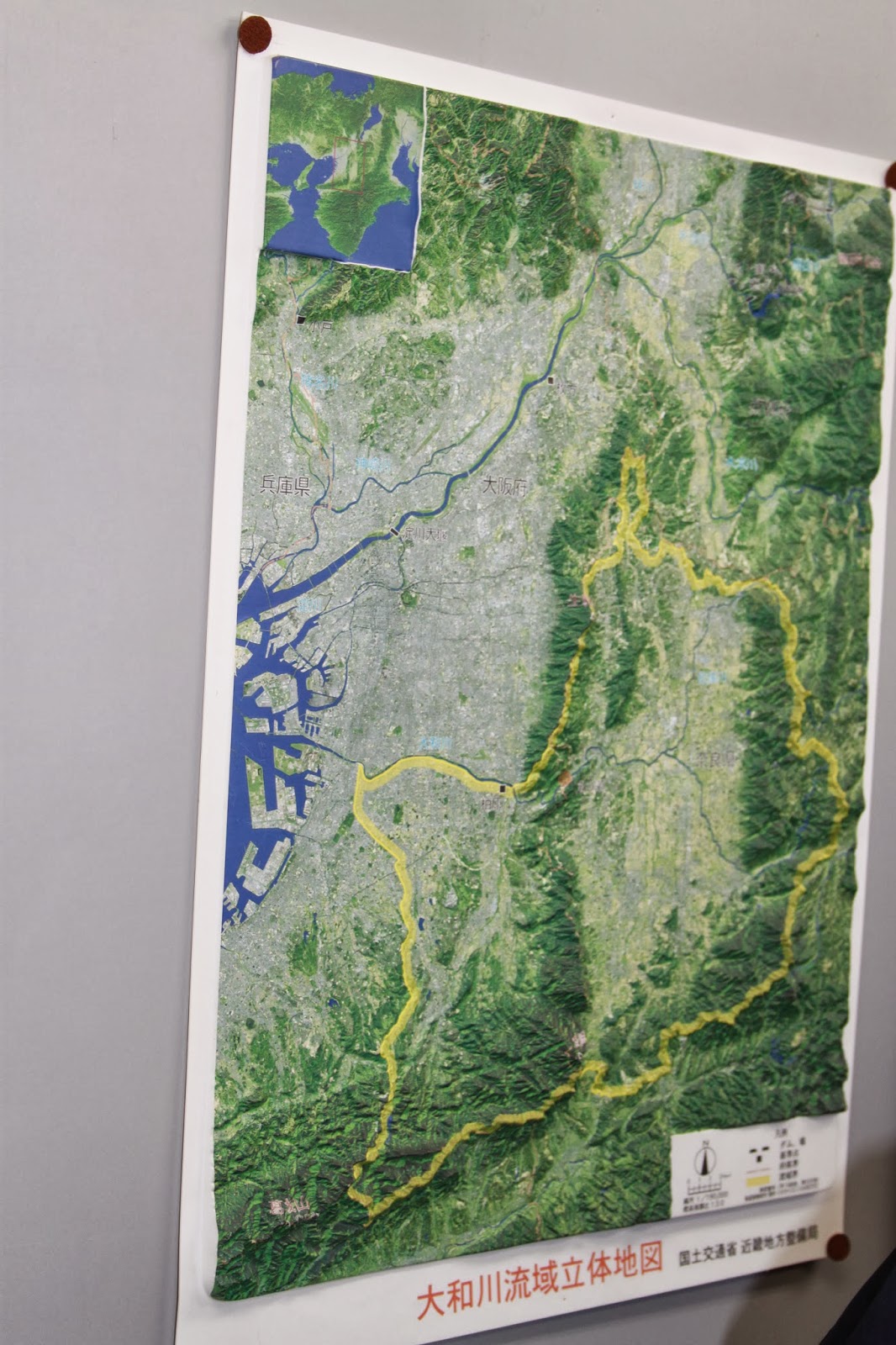
Our final stop was East of Osaka, at the Kamenose landslide area. Since the 1950s, pillars worth 40 million euro each have been put into the mountain. The top sand layer of the mountain has been removed, and an intricate network of tunnels and filters has been installed, all in order to prevent landslides. The Yamato river, whose basin originates in the Nara area, has only one way to flow to the ocean. This is at the Kamenose landslide area, where two mountain ranges are briefly intersected by this river. Should a landslide occur, then the single most transportation route for humans and the river would be cut off as a natural dam would be created, and the Nara area would become a lake. Aside from the information hall, we also got to walk inside one of the tunnels themselves. Strangely enough, after these tunnels are constructed, there is no further removal of soil. Supposedly the inflow is stopped by filters. Afterwards we traveled back by shinkansen once more.