Friday, August 7, 2015

Visit to the Metropolitan Area Outer Underground Discharge Channel - part 4

Finally some photos from outside, underground in the channel itself, and the pumps in the main building. 


More information from previous visits to the MAOUDC can be found in these posts from August 2011 - August 2011 information - October 2011.

Visit to the Metropolitan Area Outer Underground Discharge Channel - part 3

We enjoyed watching the English video about the MAOUDC with students from the Tokyo University international summer course, who are learning to use the IFAS software at ICHARM this week. 
 
The command center from which the water volumes in separate sections can be managed.


 It was a cool 20 degrees at the bottom of the tunnel.


Visit to the Metropolitan Area Outer Underground Discharge Channel - part 2

Not much has changed since my visits in 2011, but I did get the chance to take more pictures of the information boards in the hallway. 

The first map, with North to the left, shows the projects in the Edo river including super levees.


The next boards elaborate on the concept of super levees. Ideally the whole bank will be completed, but due to financial and political constraints it remains an ongoing process. Another impacting factor is that the prefectural boundary is chosen at the river course, so theTokyo Metropolitan Government is developing super levees on the west side of the river and not the opposite side.


This board shows the river disaster preparedness center.

Finally, something about the MAOUDC itself.

Here the water distribution between Edo, Naka and Ayase river is explained (more pictures of projects of lowland rivers in Tokyo here).

The various areas in Tokyo affected by the Edo river are shown on the right hand side.

This board goes far back into history, showing Tokyo bay 9,000, 5,500 and 4,000 years ago. The landscape and overall shape of the bay have changed dramatically, both enlarging and decreasing in size. As there used to be an inland sea, during the channel construction many sea shells and other remains of marine life were excavated.


The MAOUDC is chosen as one of the locations to see mount Fuji from.

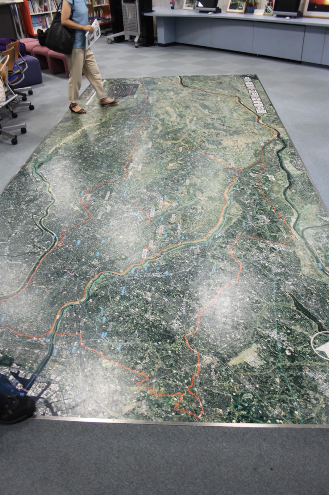
A better picture of the 3D elevation map, showing the bowl structure Tokyo is in and how elevated the river levees are compared to the surrounding landscape. 

Thursday, August 6, 2015

Visit to the Metropolitan Area Outer Underground Discharge Channel - part 1

Members of the ICHARM Risk Team joined with the students from the Tokyo University international summer course, who are learning to use the IFAS software at ICHARM this week, to visit the MAOUDC.

Already at the rest stop there were informative boards from the MLIT on places we visited before, including super levees, the statue in honor of the Dutch engineer Anthonie Rouwenhorst Mulder at the Nagareyama canal that connects the Tone and Edo rivers, and the discharge channel itself.


Here are links with more information from previous visits to the MAOUDC in August 2011 - August 2011 information - October 2011 and comparable underground storage facilities in November 2011.