Showing posts with label Storm. Show all posts

Friday, December 23, 2016

News in Japan - December

USA

Netherlands
Dutch coast ‘superstorm’ proof for the next 50 years The embankments that protect the marina have been topped with Xblocs to break high waves. Xbloc is an innovative concrete armour unit which has been developed by Dutch contractor BAM - under its trade name Delta Marine Consultants - for shore protection and breakwaters. Xblocs have a high hydraulic stability and requires considerably less concrete compared to other armouring systems and furthermore the units can be placed faster. This is the first time Xblocs have been used along the Dutch coast.
PhD-student experimented with 10.000 plastic river plants in waterlab, the Netherlands In the main channel of the waterlab at Delft University of Technology in the Netherlands, PhD-student Andrés Vargas-Luna simulated the shaping of rivers including the effects of vegetation. He did this by putting 10.000 small plastic plants in the channel. "Problems arise when trying to calculate their extension as there are no models for this. It is often assumed that the land that erodes from one bank, expands the other. I want to know which role vegetation plays in the development of riverbanks.” The outcomes of his research emphasize the relevance of considering the effects of vegetation on the river management and on the designing, planning and maintaining of restoration projects.

Other
Most UK coastal flooding caused by moderate, not extreme storms The researchers also identified four main storm track pathways approaching the UK (mainly from the westerly and northerly directions) and four broad corresponding footprints of extreme sea level events (four sections, which together, make up most of Britain's mainland coastline). Clustering of storms, such as happened during the 2013 -- 14, or even 2015 -- 16 season, is an important issue. It can lead to large socioeconomic impacts and cumulative insurance losses. Before now, knowledge of this area has been limited, but our study will help better inform flood management, the insurance sector, and national emergency and infrastructure resilience planning to minimise the impact of successive storm events. The team has also developed a new database of coastal flooding for the UK called 'SurgeWatch' (http://www.surgewatch.org) which contains records, including photographs, of coastal flooding events over the last 100 years.

Thursday, December 1, 2016

Joso flood - ICHARM publication

My colleagues have just published an article in the Journal of Disaster Research, titled "The 2015 Flood Impact due to the Overflow and Dike Breach of Kinu River in Joso City, Japan" (doi: 10.20965/jdr.2016.p1112). You can access the full article for free by registering on the website for free as a member. This article discusses not only the geographic features making the area prone to flooding, but also the lead time to evacuation per district.

Abstract:
Heavy rainfall in September 2015 inundated the Kinu River basin and caused an overflow and dike breach of the river in the eastern part of Joso City, Ibaraki Prefecture, Japan. The area, which is bounded by the Kinu and Kokai Rivers, experienced deep inundation of more than 2.5 m, which continued for more than 3 days at the maximum level. Although the estimated maximum inundation depth and duration were basically related to the elevation and distribution of topographic surfaces, strong flood flow washed buildings away near the overflow and dike breach sites and caused deep inundation even though these sites were located on a relatively higher natural levee. In addition, serious damages such as interruption of emergency transportation routes and deep inundation over floor level occurred, isolating evacuation centers and important facilities including a municipal hall and hospitals. Few residents utilized the pre-prepared flood hazard map or understood the local geography, and evacuation orders were not fully transmitted to the local residents, which might have increased the flood’s impact.

Wednesday, November 30, 2016

News in Japan - November

USA:
Mississippi River could leave farmland stranded
If the Mississippi River continues to go unchecked, the farmland on Dogtooth Bend peninsula may be only accessible by boat. According to a University of Illinois study, each successive flood carves a deeper channel across the narrow neck of the peninsula. This floodwater shortcut threatens to permanently reroute the Mississippi River, leaving Dogtooth Bend an island rather than a peninsula. Repeatedly repairing the levee breaches, building a bridge over the shortcut created by the flooding, or letting the Mississippi chart its own course are some solutions to the problem.

Netherlands: 
New Dutch drama, ‘if the levees breach’: http://www.npo.nl/series/artikelen/als-de-dijken-breken
Website visualizing floods in the Netherlands: http://www.overstroomik.nl/
Cadzand-Beach most closely resembles Omaha Beach (Dutch) For the first time enormous Xblocs, an innovation of construction consortium BAM, are applied in the Netherlands. They must protect the hinterland from so-called super storms that may arise from a combination of sea level rise and climate change. The probability of such a super storm is 1 percent in a hundred years. That seems low, but without proper protection the flood damages can amount to more than one hundred billion euro. The three-dimensional shapes can be linked to each other similar to Lego-blocks, so that the connection of the resulting dam becomes extra strong. But by the openness persisting between the Xblocs, the barrier absorbs the enormous power of the super waves instead of being averted. The slender palisades also reduces the required material. A ‘small’ Xbloc consists of 1.5 cubic meters of concrete, a large one of 4 cubic meters. That is only one-third of the material which would be required for massive concrete blocks of the same size. "The gaps between the Xblocs creates space for all kinds of marine life. Small micro-organisms can settle here, but also fish and crabs find shelter. We considered mixing the concrete with shell grit, so that a large surface would be created with better adherence, but that was really too expensive." Research at Rijkswaterstaat in 2003 showed that the force with which the waves hit the shore is greater than previously thought. At nine locations along the Dutch coast dunes or dikes had to be reinforced to be able to withstand a superstorm. When Minister Schultz van Haegen (Infrastructure and Environment) formally closed the work in Cadzand today, all the weak links will have been restored.

Monday, April 18, 2016

Earthquake in South Japan - part 2

A second heavy earthquake has struck Kyushu island early Saturday morning, leading to more deaths. Below is an analysis of the earthquakes from the first 84 hours following the initial Thursday evening earthquake, along with an overview of the effects, combined with strong wind damages, and the earthquake in Ecuador.

How to help: Kumamoto quake info: where to go, how to help

Shindou 1 2 3 4 5- 5+ 6- 6+ 7 Total
2≤M<3 0 1 18 0 0 0 0 0 0 19
3≤M<4 0 6 92 26 0 0 0 0 0 124
4≤M<5 0 0 14 41 2 0 0 0 0 57
5≤M<6 0 0 0 2 4 2 2 1 0 11
6≤M<7 0 0 0 0 0 0 2 1 1 4
7≤M<8 0 0 0 0 0 0 0 2 0 2
Total 0 7 124 69 6 2 4 4 1 217

For further analysis only earthquakes on Kyushu island were taken into account, and shindou (shaking intensity) 5- and 6- were counted as 5.0 and 6.0 whereas 5+ and 6+ were counted as 5.5 and 6.6 respectively. 

Monday, February 29, 2016

News in Japan - February

USA:
History Doesn’t Repeat Itself—Not Here, Anyway (USA). After discussions and deliberation between cities, states, and the federal government, many of these flood-damaged and flood-prone lands were converted into open space through government acquisitions, or “buyouts.” After 1993, parks and fields were created where homes had once stood. These areas were now easier to maintain and protect. Children could play football or soccer. Families could picnic in the summertime and build snowmen in the winter.
Record Missouri flooding was manmade calamity, scientist says Most news reports blamed it on the heavy rain, but a professor of earth and planetary sciences says analysis of the flood data shows much of the damage was due to recent modifications to the river. The flood on the middle Mississippi River, in turn, was remarkable for its short duration and the time of year. "It was essentially a winter flash flood on a continental-scale river," Criss said. "The Mississippi has been so channelized and leveed close to St. Louis that it now responds like a much smaller river." "In the meantime," he said, "inaccurate Federal Emergency Management Agency flood frequencies based on the assumption that today's river will behave as it has in the past greatly underestimate our real flood risk and lead to inappropriate development in floodways and floodplains." "The heavy rainfall was probably related to El Niño, and possibly intensified by global warming. But new records were set only in areas that have undergone intense development, which is known to magnify floods and shorten their timescales. "People want to blame the rain, but this is mostly us," Criss said. "It's a manmade disaster." During the New Year's flood, roughly 7,000 buildings near St. Louis were damaged, two interstate highways were closed for several days, the community of Valley Park was evacuated, and two Metropolitan Sewer District plants were swamped so that sewage was dumped directly into the water. The flood killed more than 20 people in Missouri and Illinois, caused several hundred million dollars of damage, and left millions of tons of debris in its wake.
The best way to protect us from climate change? Save our ecosystems There is now clear evidence that intact forests have a positive influence on both planetary climate and local weather regimes. Forests also provide shelter from extreme weather events, and are home to a host of other valuable ecosystems that are important to human populations as sources of food, medicine and timber. In Vietnam, 12,000 hectares of mangroves have been planted at a cost of US$1.1 million, but saving the US$7.3 million per year that would have been spent on maintaining dykes. In Louisiana, the destruction of Hurricane Katrina in 2005 led to an examination of how coastal salt marshes might have reduced some of the wave energy in the hurricane-associated storm surges. Data have now confirmed that salt marshes would have significantly reduced the impact of those surges, and stabilised the shoreline against further insult, at far less cost than engineered coastal defences. With this data in hand, discussions are now beginning around how to restore the Louisiana salt marshes to insulate against future extreme weather events.
Flavour of Dutch dialogues gets into 1 billion dollar US disaster resilience plans Morris has been closely involved in the competition and emphasises the tremendous Dutch influence in these projects. In particular, he mentions the climate adaptive approach that focusses on disaster prevention, and on the involvement of many stakeholders right from the start. "This is a distinct Dutch approach to urban planning", says Morris. "Also the involvement of landscape architecture shows the Dutch influence in these projects". "With the two competitions the housing department provokes the states and the local communities to think about their future and the social-economic development. The US is well organized on reactive disaster response. The competitions made them think of the future and long term planning for smart investments." 

Netherlands:

Vulnerable People:

Other:
With a 21 percent share of the national gross domestic product (GDP) and a 45 percent share of Pakistan's total workforce, it is crucial that agriculture be able to prevent and mitigate the impact of disasters.
Human-made climate change helped cause south of England floods, say scientists anthropogenic greenhouse gas emissions increased the risk of the once-a-century wet January in 2014 by 43% (uncertainty range: 0-160%). The heightened risk of rainfall found in the meteorological modelling led to an increase in the peak 30-day river flow of 21% (uncertainty range: -17-133%) and about 1,000 more properties at risk of flooding (uncertainty range: -4,000-8,000).
Borrowed Time on Disappearing Land (Bangladesh) “These migrants should have the right to move to the countries from which all these greenhouse gases are coming. Millions should be able to go to the United States.” Making matters worse, much of what the Bangladeshi government is doing to stave off the coming deluge — raising levees, dredging canals, pumping water — deepens the threat of inundation in the long term. In an analysis of decades of tidal records published in October, Dr. Pethick found that high tides in Bangladesh were rising 10 times faster than the global average. He predicted that seas in Bangladesh could rise as much as 13 feet by 2100, four times the global average. “The reaction among Bangladeshi government officials has been to tell me that I must be wrong,” he said. “That’s completely understandable, but it also means they have no hope of preparing themselves.” “There is no doubt that preparations within Bangladesh have been utterly inadequate, but any such preparations are bound to fail because the problem is far too big for any single government,” said Tariq A. Karim, Bangladesh’s ambassador to India. “We need a regional and, better yet, a global solution. The family reunited on the road the next day after the children spent a harrowing night avoiding snakes that had sought higher ground, too. They drank rainwater until rescuers arrived a day or two later with bottled water, food and other supplies. In the weeks after the storm, the women of Dakope found firewood by wading into the raging river and pushing their toes into the muddy bottom. They walked hours to buy drinking water. “I don’t want to stay here (slums) for too long,” Mr. Gazi said. “If we can save some money, then we’ll go back. I’ll work on a piece of land and try to make it fertile again.” But the chances of finding fertile land in his home village, where the salty rivers have eaten away acre upon acre, are almost zero.

Friday, October 30, 2015

News in Japan - October

GEJET:
TEPCO rejected requests for anti-tsunami steps before nuclear crisis
First cancer case confirmed from Fukushima cleanup

Japan:
Behind the Scenes / Concern for privacy of Joso missing excessive
Volunteers mucking in to help Japan clean-up

USA:
Hurricane Patricia Recap: Strongest Landfalling Pacific Hurricane on Record
Flood risk on rise for New York City, New Jersey coast, study finds
One-two punch of rising seas, bigger storms may greatly magnify US East coast floods

Netherlands:
Pop-up Exhibition in Dordrecht on potential flood disasters

Other:
In dryland African regions, limiting wildlife water access can reduce water quality
NASA studying 2015 El Nino event as never before
Want To Know How Sea Level Rise Will Impact Your Hometown? There’s A Map For That
Surging seas mapping progress
Researchers work on model to help restoration managers with decision-making (USA, Germany)
Why some scientists are worried about a surprisingly cold ‘blob’ in the North Atlantic Ocean
Work starts on Sendai indicators

Vulnerable People:
Japan’s child poverty above OECD average
Shibuya Ward to begin accepting applications for 'same-sex partnership certificates'

Japanese flood and landslides:
Here are the latest statistics from the Japanese government's Fire and Disaster Management Agency and other national and local governments as of Friday, Sept. 18:
•        The death toll is eight: three in Tochigi Prefecture, three in Ibaraki Prefecture, and two in Miyagi Prefecture.
•        There are 46 confirmed injuries, with Ibaraki Prefecture accounting for 24 of them.
•        A total of 18,882 dwellings have been confirmed flooded. Ibaraki leads this list as well, with 12,088 flooded homes.
•        In addition to the flooded homes, 16 dwellings have been destroyed and another 102 have structural damage.
•        Damage also occurred to 61 non-residential structures.
•        Damage to the agricultural, forestry and fishing industries has reached 11.7 billion yen (about 98 million U.S. dollars).
•        At least 455 landslides were reported – 358 of them in Tochigi Prefecture alone, and 312 of those in the city of Nikkō, according to the prefectural government.
•        Up to 26 inches of rain fell in eastern Japan Sunday through Friday due to Tropical Storm Etau and its remnant low.
•        Local officials in Ibaraki Prefecture said 1,344 people had been rescued via helicopter by the country's Self-Defence Force and rescuers from 10 of the country's 47 prefectures.
Key developments in the storm:
•        On Wednesday, Sept. 16, officials confimed the death of a 40-year-old man who had been out on his bicycle when the floods hit Ibaraki Prefecture on Sept. 10.
•        A 60-year-old man was found dead Saturday after the vehicle he was in was swept into a flooded river Friday morning in the city of Kurihara, Miyagi Prefecture. A 48-year-old woman also died in that incident.
•        Japanese media said a pair of eight-year-old boys were among those found alive and removed from the list of missing Saturday.
•        Two men, ages 71 and 51, were found dead in rice fields flooded by the levee breach in Joso, according to public broadcaster NHK. The men were not previously among the list of missing.
•        The Japanese government's Fire and Disaster Management Agency confirmed that a man found dead in a flooded vehicle in Tochigi Prefecture Sunday morning died of storm-related causes.
•        A 63-year-old woman was confirmed dead after a landslide struck Kanuma city, Tochigi Prefecture, early Thursday. The woman was missing for hours before being found dead Thursday evening.
•        A man in his 20s was confirmed dead Friday after falling into a flooded drainage pipe Thursday in Nikkō city, Tochigi Prefecture.
•        Rare emergency weather warnings were issued for Tochigi, Ibaraki and Miyagi prefectures on Thursday and Friday, but have all since been lowered.
•        A magnitude-5.2 earthquake struck Tokyo Bay at 5:49 a.m. local time Saturday, rattling the entire Tokyo region and prompting fears of quake-triggered landslides in rain-soaked hilly terrain.
•        The earthquake injured seven people in Tokyo and its suburbs, according to the FDMA.
•        Another earthquake, rated magnitude 4.6 and centered off the east coast of Ibaraki Prefecture, rattled the Joso flood zone nearly six hours later but with weaker ground shaking.
•        The Shibui River broke through a levee in Ōsaki city, Miyagi Prefecture, on Friday morning. At least 1,000 people were stranded in floodwaters, according to the newspaper Asahi Shimbun.
•        The Japan Meteorological Agency issued the maximum "Level 5" flood warning Friday for the Yoshida River in Miyagi Prefecture and for the Mogamiogumi River in Yamagata Prefecture.
•        More than 800 people in the mountainous town of Minamiaizu, Fukushima Prefecture, were cut off from the outside world due to flooding and landslides on the lone highway through town Friday.
The Japan Meteorological Agency issued a rare emergency heavy rainfall warning for Miyagi Prefecture and its 2.3 million residents early Friday as torrential rains continued to drench the prefecture, which includes the city of Sendai, raising concerns of landslides and river flooding. The JMA observation site near Sendai's central business district reported 269 millimeters (10.59 inches) of rain in the 24-hour period between 7:40 a.m. Thursday and 7:40 a.m. Friday local time. (Japan is 13 hours ahead of U.S. Eastern Daylight Time.) JMA lowered the warning for Miyagi Friday evening.
"We can say this is an abnormal situation and there is imminent serious danger," said Takuya Deshimaru, chief forecaster at the Japan Meteorological Agency, according to the BBC.
On Thursday, JMA issued similar emergency weather warnings for 5 million people in Tochigi Prefecture and Ibaraki Prefecture, north and northeast of Tokyo, on Thursday morning. The warnings were issued as a band of heavy rainfall associated with the post-tropical remnant of Tropical Storm Etau stalled over eastern Japan, dumping up to 21 inches of rain in 24 hours near the head of the Kunigawa River, which drains south through the northern suburbs of Tokyo.
The emergency warnings in Tochigi and Ibaraki prefectures were lowered Friday morning.

Friday, August 7, 2015

Visit to the Metropolitan Area Outer Underground Discharge Channel - part 4

Finally some photos from outside, underground in the channel itself, and the pumps in the main building. 


More information from previous visits to the MAOUDC can be found in these posts from August 2011 - August 2011 information - October 2011.

Visit to the Metropolitan Area Outer Underground Discharge Channel - part 3

We enjoyed watching the English video about the MAOUDC with students from the Tokyo University international summer course, who are learning to use the IFAS software at ICHARM this week. 
 
The command center from which the water volumes in separate sections can be managed.


 It was a cool 20 degrees at the bottom of the tunnel.


Visit to the Metropolitan Area Outer Underground Discharge Channel - part 2

Not much has changed since my visits in 2011, but I did get the chance to take more pictures of the information boards in the hallway. 

The first map, with North to the left, shows the projects in the Edo river including super levees.


The next boards elaborate on the concept of super levees. Ideally the whole bank will be completed, but due to financial and political constraints it remains an ongoing process. Another impacting factor is that the prefectural boundary is chosen at the river course, so theTokyo Metropolitan Government is developing super levees on the west side of the river and not the opposite side.


This board shows the river disaster preparedness center.

Finally, something about the MAOUDC itself.

Here the water distribution between Edo, Naka and Ayase river is explained (more pictures of projects of lowland rivers in Tokyo here).

The various areas in Tokyo affected by the Edo river are shown on the right hand side.

This board goes far back into history, showing Tokyo bay 9,000, 5,500 and 4,000 years ago. The landscape and overall shape of the bay have changed dramatically, both enlarging and decreasing in size. As there used to be an inland sea, during the channel construction many sea shells and other remains of marine life were excavated.


The MAOUDC is chosen as one of the locations to see mount Fuji from.

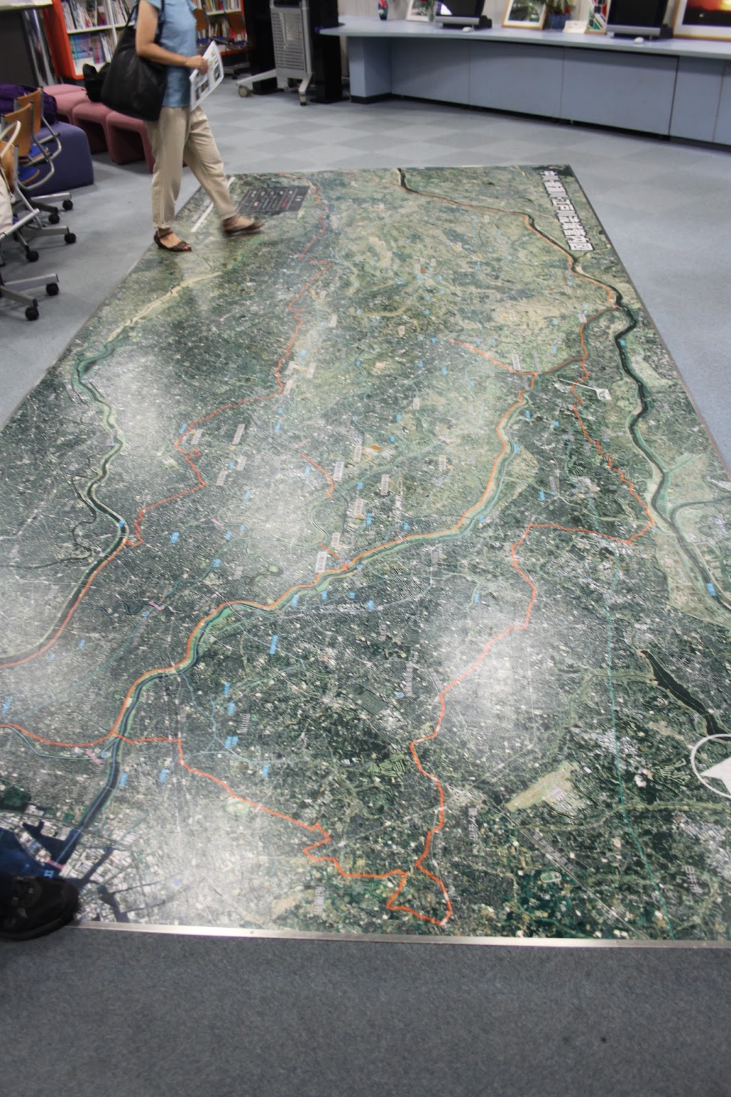
A better picture of the 3D elevation map, showing the bowl structure Tokyo is in and how elevated the river levees are compared to the surrounding landscape. 

Thursday, August 6, 2015

Visit to the Metropolitan Area Outer Underground Discharge Channel - part 1

Members of the ICHARM Risk Team joined with the students from the Tokyo University international summer course, who are learning to use the IFAS software at ICHARM this week, to visit the MAOUDC.

Already at the rest stop there were informative boards from the MLIT on places we visited before, including super levees, the statue in honor of the Dutch engineer Anthonie Rouwenhorst Mulder at the Nagareyama canal that connects the Tone and Edo rivers, and the discharge channel itself.


Here are links with more information from previous visits to the MAOUDC in August 2011 - August 2011 information - October 2011 and comparable underground storage facilities in November 2011.

Friday, June 26, 2015

News in Japan - June

Japan:
Ocean Cleanup announces world's first floatable ocean cleanup installation near Tsushima island, Japan Every year 30,000 cubic meters of trash is deposited on its shores. The collection of this garbage costs about 5 million USD annually. Tsushima island is evaluating whether the plastic can be used as an alternative energy source.
Below 96 percent of Japan elementary, junior high schools quake-resistant
Heavy rain hits Japan's Kyushu; 370,000 advised to evacuate
PREPARING FOR THE BIG ONE: THE JAPANESE EARTHQUAKE MINDSET

USA:
Severe flooding hits central Texas, Oklahoma TRMM/GPM are a joint missions between NASA and the Japanese space agency JAXA.
New tools aiding storm prediction, increasing ship navigational safety in Gulf of Mexico

Netherlands:
Ambitious 850 million reinforcement will make the Afsluitdijk a new icon of Dutch flood protection
Floods as war weapons A new study shows that, from 1500 until 2000, about a third of floods in southwestern Netherlands were deliberately caused by humans during wartimes. Some of these inundations resulted in significant changes to the landscape, being as damaging as floods caused by heavy rainfall or storm surges.
75% of Dutch people cannot reanimate (Dutch) 60% cannot locate nearest AED. Every week 300 Dutch people have a cardiac arrest outside of the hospital, having an average age of 66 years.

Other:
Flash flood risks increase as storm peak downpours intensify (Australia) "It means that most people in Australia can expect to see intensification in the magnitude of flash flooding in smaller catchments, particularly in urban or residential areas" The increase in flood peaks are estimated to be about 19% for Hobart, 12% for Sydney, 10% for Perth, and 45% in Darwin
Researchers to help create 'early-warning systems' through social media to combat future disasters (global)
Global risks: Pool knowledge to stem losses from disasters by Cutter, Takeuchi et al

Sediment makes it harder for baby Nemo to breathe easy Researchers have discovered that suspended sediment damages fish gills and can increase the rate of disease in fish.
Victim and major damage by severe weather in Germany (Dutch) - Dode en veel schade Duitsland door noodweer A 49 year old male died when hit by a falling tree branch. Six people were injured by a lightning strike.

Vulnerable people:
The sedentary office: a growing case for change towards better health and productivity. Expert statement commissioned by Public Health England and the Active Working Community Interest Company for those occupations which are predominantly desk based, workers should aim to initially progress towards accumulating 2 h/day of standing and light activity (light walking) during working hours, eventually progressing to a total accumulation of 4 h/day (prorated to part-time hours).
Foreign same-sex couples here enjoy rights that Japanese don't

Critique on the Sendai Framework process:
Expertise and policy-making in disaster risk reduction “Despite their presence, NGOs, civil society groups, and scientific experts were not allowed to participate in the formal negotiations. Diplomats would have benefited of the expertise from the scientific community and civil society groups as the delegates showed a very limited understanding of disaster risk reduction (DRR) and the broader concept of  resilience during the negotiation.“ “Many delegates seemed most interested in promoting their national interests, suppressing wording that cemented commitments, rather than discussing the substance of the proposed framework.” “In general, much of the research done by the scientific community and NGOs — research that was centralized in the Global Assessment of Disaster Reduction 2015 (GAR), and presented at the conference specifically to inform decision-makers — was widely neglected in the final agreement. As a result, the Sendai Framework lacks scientific substance, contains many loosely conceptualized targets, and poorly represents the amount of research presented during the conference.”
“These formal negotiations were closed to both the public and conference participants, and probably reduced the pressure on diplomats to integrate the suggestions from the immediately available expertise. While exclusion of these actors in the formal process may make formal agreements easier to reach, the result is a framework that lacks ambition, especially considering that it is not legally binding.”
”First, there must be direct participation of the scientific community in the negotiations”
“Second, there is a need to make the GAR more central to the negotiations, in a similar manner to the IPCC, to make it harder for decision-makers to ignore it.”
“Third, more opportunities for communication and mutual learning should have been provided at the conference.“
Colin Walch is in the Department of Peace and Conflict Research and Centre for Natural Disaster Science (CNDS) in Sweden.

Friday, April 17, 2015

7th WWF day 6

7th World Water Forum in Daegu and Gyeongju, Korea - day 6

In the morning at 9:00 ICHARM organized the closing session of the Theme Water and Disasters. We had over 60 people turn up to the session, which launched the Implementation Roadmap with actions to be taken on this theme between now and the next WWF in Brazil, 2018. After our session, we checked up on the exhibition booth and placed the final documents online, which you can find here under 'documents'. The final closing ceremony was a massive event with over 700 people and many prizes awarded. 

Thursday, April 16, 2015

7th WWF day 5

7th World Water Forum in Daegu and Gyeongju, Korea - day 5

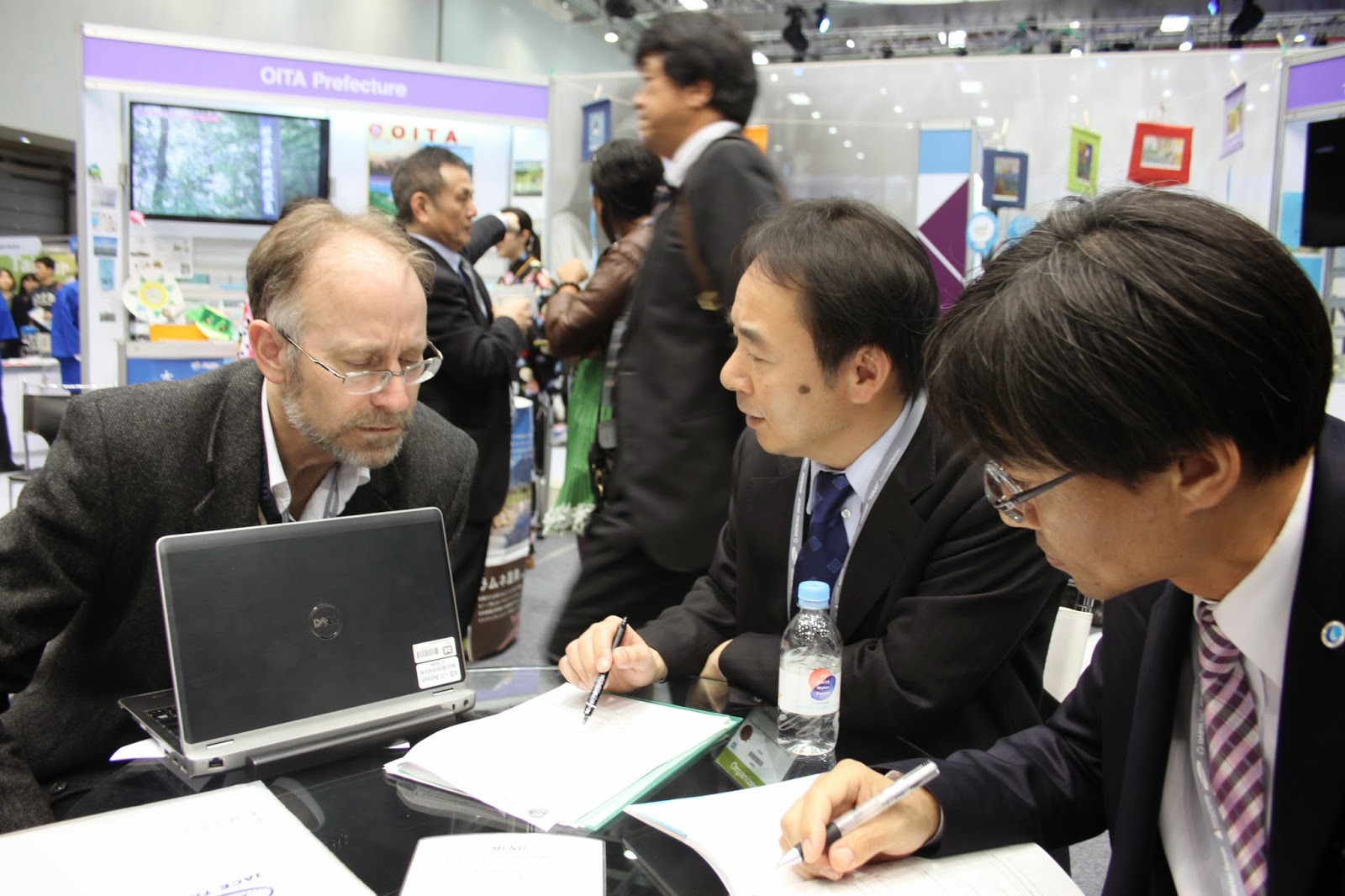
We spent most of the morning meeting coordinating our concluding session on the last day of the forum. We still had to finalize the schedule, create handouts for the audience, and place as much materials online as possible. Luckily there was a little time left over to catch up with people from the Xiamen international water law department from China, before attending two sessions and being whisked away to a dinner with the typhoon committee. 


Wednesday, April 15, 2015

7th WWF day 4

7th World Water Forum in Daegu and Gyeongju, Korea - day 4

There was time to visit three sessions today in Daegu, on the topics of water justice, governance indicators, and monitoring risks.

Monday, April 13, 2015

7th WWF day 2

7th World Water Forum in Daegu and Gyeongju, Korea - day 2

I visited four events today, starting with the opening ceremony of the thematic sessions, followed by two thematic sessions on the human right of water and water policies, and finally a scientific session on climate change impact and vulnerability.

Sunday, April 12, 2015

7th WWF day 1

7th World Water Forum in Daegu and Gyeongju, Korea - day 1

Today was the first day of the world water forum. We joined the opening ceremony on Daegu, at the exhibition center called EXCO. As it was quite crowded, there was a special room for VIP members to view the ceremony live, and another room for additional visitors to watch it on screens. In total, the secretariat reports there were over 3,000 people attending the opening ceremony. Security was heavy as President Park of Korea and many other heads of state were present in the building. As in Japan, Korea likes the use of mascots and we were treated abundantly with examples of traditional clothing, dances, sports, and many other cultural aspects.

Tuesday, March 17, 2015

WCDRR day 4

World Conference on Disaster Risk Reduction in Sendai - day 4

Today I visited the AER TKP garden city building for a symposium with Japanese, Dutch and Italian experts on Disaster Risk Reduction. Many examples of infrastructure merging with local ecosystems and population demands were explained.

Monday, March 16, 2015

WCDRR day 3

World Conference on Disaster Risk Reduction in Sendai - day 3

In the middle of this conference I was able to visit 5 events on this day. The first was a technical session on the methods used in the Global Assessment Report 2015 at Tohoku university. The second and third took place at the International Center and covered financial aspects of disaster risk reduction. Another session there covered land use planning, while the last, at Tohoku university, was a very special session about the formation of a Delta Alliance, initiated by the Dutch government and attended by one of the Dutch princesses. 

Sunday, March 15, 2015

WCDRR day 2

World Conference on Disaster Risk Reduction in Sendai - day 2

Today I visited 4 sessions, the first three at the Sendai international conference building and the last at Tohoku University, located on a beautiful hill side, at Hagi hall (presentations will follow). The hagi tree is the symbol of the university.
My main question during the presentation of the Global Assessment Report 2015 was how the work of the GAR differs from ICHARM's goal to make a risk index. The main points include ICHARM's focus on flood hazards, end point indicators of governance and resilience of communities, and the national level and cooperation with national governments in creating and applying the index data.