Saturday, June 29, 2013

News in Japan - June

USA

Floods in Europe

GEJET


Netherlands

Typhoon

Social

Other

Thursday, June 13, 2013

Field Trip to Tohoku area - Day 3

On the last day of the field trip to the Tohoku area, we visited Kesennuma city and Rikuzentakata. While Kesennuma didn't have a broad flat coastal area, it was heavily dependent on the fishing industry and it lost nearly all of it's income.


We received many statistics from the municipality. Due to the tsunami, 1041 people died and 239 are still missing. 26,048 houses were damaged, which is 40.8% of all houses.

The tsunami height was 20 meter, and the subsequent land subsidence was 74 cm. Because of this, all coastal roads are to be heightened to 1.8 meter. In preparation of this, some roads have already been raised by 50 cm. T.P. refers to Tokyo Peil, Peil being the Dutch word for level and referring to the mean sea level at Tokyo.


Kesennuma also has a temporary shopping mall set up.


Although many buildings survived, there are also many that have been washed away or demolished since, and the buildings left standing are either still bearing the marks of the rubble that swept by, or temporary units. In the foundations the original layout of the buildings can still be seen, such as the toilet.


Though there are many hills surrounding the harbor area, only few are equipped with evacuation staircases. At some locations further uphill signs have been installed to show the height of the tsunami.


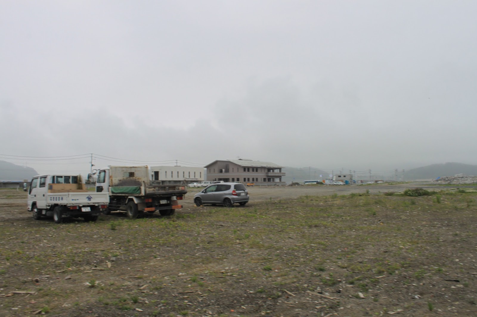
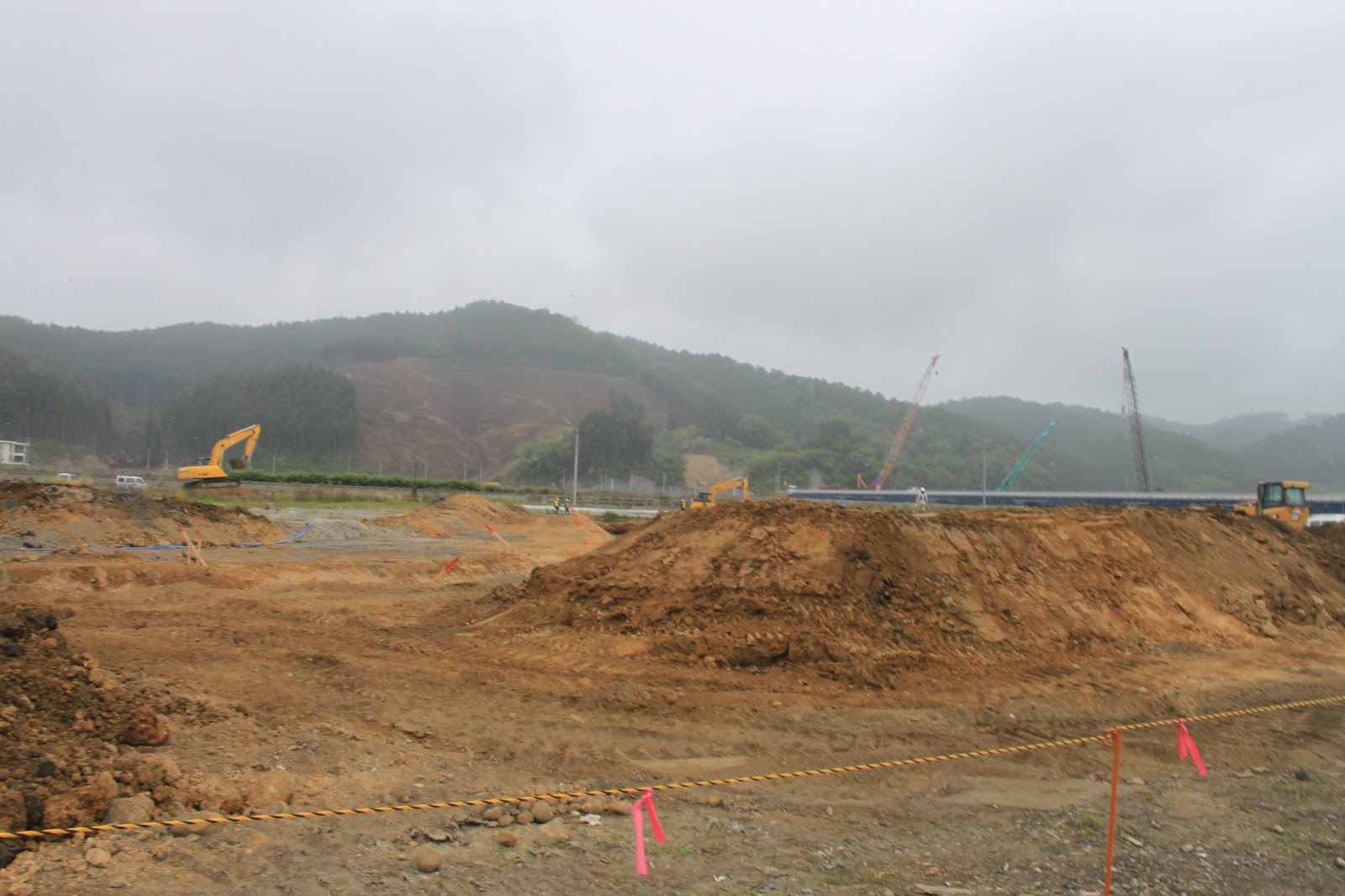
On the way to Rikuzentakata, we encountered more signs of the destruction. Many times the valleys were marked with past tsunami inundation section start and end, and transformed into rubble handling factories. The hills were used for temporary housing units, and the roads are filled with trucks transporting sand and debris. 


In Rikuzentakata, the tsunami hit area was over 4.5 km wide. Due to recovery efforts, this is now a large open plain with only some foundations left. The preserved pine tree was placed here as a symbol of hope. Below is a panoramic view of the plains which were once the city. 


Finally we visited a museum where a documentary of the GEJET was displayed, both in pictures and in retrieved items from the rubble. It also features historical images of past tsunamis, which emphasized the lack of bodies in the rubble we have seen in the media so far.


Tuesday, June 11, 2013

Field Trip to Tohoku Area - Day 2

On the second day of the field trip to the Tohoku area we visited a different MLIT area with disaster management vehicles, and we traveled to the disaster hit areas Ishinomaki city and the Kitakami river mouth.

The vehicles we saw in action (as demonstration) included a pumping vehicle (35 million yen, runs on diesel), a disaster center vehicle and additional sleeping unit vehicle (each 20 million yen), a remote controlled excavator (100 million yen), and a lighting vehicle. The excavator could be disassembled into 15 pieces and transported by helicopter. It also provided video feed so workers do not have to be placed in danger while the work can still be performed.


The MLIT center was also hit by the tsunami, and the water can about 1 meter high inside the building. Next door a building functioned as an evacuation building, and about 100 people took shelter on the roof during the tsunami. The building is about 10 meter high, and the water came up to 1.8 meter. The salt water also caused certain plants at the MLIT building to die. The plan is to eventually remove and replace them. A new office is being constructed at a higher place.


In the afternoon we visited Kamaishi, where the hospital is in the process of being broken down. There is only one hill between the sea and the mountains, with a temple. From here we also saw the western island in the river, with the manga museum (a picture of the museum one month after the tsunami can be found here). The city is now working on getting inhabitants to agree on new levees, but in some areas there are still discussions as to the exact height and shape of the levees.


On the way there were houses marked with numbers. These codes vary per municipality and are also found on cars and boats. 


The Kitakami river mouth was nearly completely washed away. Much of the area has now become a marshland, but recovery is on the way. By constructing coffer dams, this area was treated in different sections. First the rubble was carefully searched for survivors and bodies, after which the rubble could be removed. Next the area was drained and the land surface was heightened. In this particular area, 40 people are still missing, so they are still being looked for in the remaining sections. At the elementary school, 70 of the 140 teachers and students had died. 


Further along the road north were the remains of a local disaster building. We stopped at the Minamisanriku temporary shopping hall where a Moai statue has been donated. Since the JR train tracks have been washed away along the coast, there is a bus service instead.