Showing posts with label Tokyo. Show all posts

Wednesday, March 2, 2016

Asian Water Cycle Symposium 2016 (AWCS2016) - Day 2

Day 2 of the Asian Water Cycle Symposium began with a drought session featuring former ICHARM member Dr. Ali Chavoshian, who is now Director of the RCUWM in Iran. Given the high number of people affected by droughts, an Integrated Drought Monitoring/Prediction System in West and Central Asia is promoted. This system will:

  1. Providing drought information based on multiple indicators and data sources including satellite observations and local ground-based data.
  2. Providing multi-model multi-index seasonal drought prediction information for the region.  
  3. Develop a user-friendly system for dissemination of the Drought information. 
PhD student Yohei Sawada from the Tokyo University introduced a monitoring system including the Leaf Area Index.

Tuesday, March 1, 2016

Asian Water Cycle Symposium 2016 (AWCS2016) - Day 1

The Asian Water Cycle Symposium was held at the Takeda Hall of Tokyo University, partly in commemoration of ICHARM's 10 year anniversary. Over 100 visitors from in and outside Japan joined to share experiences of water related issues in their countries.


Friday, October 30, 2015

News in Japan - October

GEJET:
TEPCO rejected requests for anti-tsunami steps before nuclear crisis
First cancer case confirmed from Fukushima cleanup

Japan:
Behind the Scenes / Concern for privacy of Joso missing excessive
Volunteers mucking in to help Japan clean-up

USA:
Hurricane Patricia Recap: Strongest Landfalling Pacific Hurricane on Record
Flood risk on rise for New York City, New Jersey coast, study finds
One-two punch of rising seas, bigger storms may greatly magnify US East coast floods

Netherlands:
Pop-up Exhibition in Dordrecht on potential flood disasters

Other:
In dryland African regions, limiting wildlife water access can reduce water quality
NASA studying 2015 El Nino event as never before
Want To Know How Sea Level Rise Will Impact Your Hometown? There’s A Map For That
Surging seas mapping progress
Researchers work on model to help restoration managers with decision-making (USA, Germany)
Why some scientists are worried about a surprisingly cold ‘blob’ in the North Atlantic Ocean
Work starts on Sendai indicators

Vulnerable People:
Japan’s child poverty above OECD average
Shibuya Ward to begin accepting applications for 'same-sex partnership certificates'

Japanese flood and landslides:
Here are the latest statistics from the Japanese government's Fire and Disaster Management Agency and other national and local governments as of Friday, Sept. 18:
•        The death toll is eight: three in Tochigi Prefecture, three in Ibaraki Prefecture, and two in Miyagi Prefecture.
•        There are 46 confirmed injuries, with Ibaraki Prefecture accounting for 24 of them.
•        A total of 18,882 dwellings have been confirmed flooded. Ibaraki leads this list as well, with 12,088 flooded homes.
•        In addition to the flooded homes, 16 dwellings have been destroyed and another 102 have structural damage.
•        Damage also occurred to 61 non-residential structures.
•        Damage to the agricultural, forestry and fishing industries has reached 11.7 billion yen (about 98 million U.S. dollars).
•        At least 455 landslides were reported – 358 of them in Tochigi Prefecture alone, and 312 of those in the city of Nikkō, according to the prefectural government.
•        Up to 26 inches of rain fell in eastern Japan Sunday through Friday due to Tropical Storm Etau and its remnant low.
•        Local officials in Ibaraki Prefecture said 1,344 people had been rescued via helicopter by the country's Self-Defence Force and rescuers from 10 of the country's 47 prefectures.
Key developments in the storm:
•        On Wednesday, Sept. 16, officials confimed the death of a 40-year-old man who had been out on his bicycle when the floods hit Ibaraki Prefecture on Sept. 10.
•        A 60-year-old man was found dead Saturday after the vehicle he was in was swept into a flooded river Friday morning in the city of Kurihara, Miyagi Prefecture. A 48-year-old woman also died in that incident.
•        Japanese media said a pair of eight-year-old boys were among those found alive and removed from the list of missing Saturday.
•        Two men, ages 71 and 51, were found dead in rice fields flooded by the levee breach in Joso, according to public broadcaster NHK. The men were not previously among the list of missing.
•        The Japanese government's Fire and Disaster Management Agency confirmed that a man found dead in a flooded vehicle in Tochigi Prefecture Sunday morning died of storm-related causes.
•        A 63-year-old woman was confirmed dead after a landslide struck Kanuma city, Tochigi Prefecture, early Thursday. The woman was missing for hours before being found dead Thursday evening.
•        A man in his 20s was confirmed dead Friday after falling into a flooded drainage pipe Thursday in Nikkō city, Tochigi Prefecture.
•        Rare emergency weather warnings were issued for Tochigi, Ibaraki and Miyagi prefectures on Thursday and Friday, but have all since been lowered.
•        A magnitude-5.2 earthquake struck Tokyo Bay at 5:49 a.m. local time Saturday, rattling the entire Tokyo region and prompting fears of quake-triggered landslides in rain-soaked hilly terrain.
•        The earthquake injured seven people in Tokyo and its suburbs, according to the FDMA.
•        Another earthquake, rated magnitude 4.6 and centered off the east coast of Ibaraki Prefecture, rattled the Joso flood zone nearly six hours later but with weaker ground shaking.
•        The Shibui River broke through a levee in Ōsaki city, Miyagi Prefecture, on Friday morning. At least 1,000 people were stranded in floodwaters, according to the newspaper Asahi Shimbun.
•        The Japan Meteorological Agency issued the maximum "Level 5" flood warning Friday for the Yoshida River in Miyagi Prefecture and for the Mogamiogumi River in Yamagata Prefecture.
•        More than 800 people in the mountainous town of Minamiaizu, Fukushima Prefecture, were cut off from the outside world due to flooding and landslides on the lone highway through town Friday.
The Japan Meteorological Agency issued a rare emergency heavy rainfall warning for Miyagi Prefecture and its 2.3 million residents early Friday as torrential rains continued to drench the prefecture, which includes the city of Sendai, raising concerns of landslides and river flooding. The JMA observation site near Sendai's central business district reported 269 millimeters (10.59 inches) of rain in the 24-hour period between 7:40 a.m. Thursday and 7:40 a.m. Friday local time. (Japan is 13 hours ahead of U.S. Eastern Daylight Time.) JMA lowered the warning for Miyagi Friday evening.
"We can say this is an abnormal situation and there is imminent serious danger," said Takuya Deshimaru, chief forecaster at the Japan Meteorological Agency, according to the BBC.
On Thursday, JMA issued similar emergency weather warnings for 5 million people in Tochigi Prefecture and Ibaraki Prefecture, north and northeast of Tokyo, on Thursday morning. The warnings were issued as a band of heavy rainfall associated with the post-tropical remnant of Tropical Storm Etau stalled over eastern Japan, dumping up to 21 inches of rain in 24 hours near the head of the Kunigawa River, which drains south through the northern suburbs of Tokyo.
The emergency warnings in Tochigi and Ibaraki prefectures were lowered Friday morning.

Friday, August 7, 2015

Visit to the Metropolitan Area Outer Underground Discharge Channel - part 4

Finally some photos from outside, underground in the channel itself, and the pumps in the main building. 


More information from previous visits to the MAOUDC can be found in these posts from August 2011 - August 2011 information - October 2011.

Visit to the Metropolitan Area Outer Underground Discharge Channel - part 3

We enjoyed watching the English video about the MAOUDC with students from the Tokyo University international summer course, who are learning to use the IFAS software at ICHARM this week. 
 
The command center from which the water volumes in separate sections can be managed.


 It was a cool 20 degrees at the bottom of the tunnel.


Visit to the Metropolitan Area Outer Underground Discharge Channel - part 2

Not much has changed since my visits in 2011, but I did get the chance to take more pictures of the information boards in the hallway. 

The first map, with North to the left, shows the projects in the Edo river including super levees.


The next boards elaborate on the concept of super levees. Ideally the whole bank will be completed, but due to financial and political constraints it remains an ongoing process. Another impacting factor is that the prefectural boundary is chosen at the river course, so theTokyo Metropolitan Government is developing super levees on the west side of the river and not the opposite side.


This board shows the river disaster preparedness center.

Finally, something about the MAOUDC itself.

Here the water distribution between Edo, Naka and Ayase river is explained (more pictures of projects of lowland rivers in Tokyo here).

The various areas in Tokyo affected by the Edo river are shown on the right hand side.

This board goes far back into history, showing Tokyo bay 9,000, 5,500 and 4,000 years ago. The landscape and overall shape of the bay have changed dramatically, both enlarging and decreasing in size. As there used to be an inland sea, during the channel construction many sea shells and other remains of marine life were excavated.


The MAOUDC is chosen as one of the locations to see mount Fuji from.

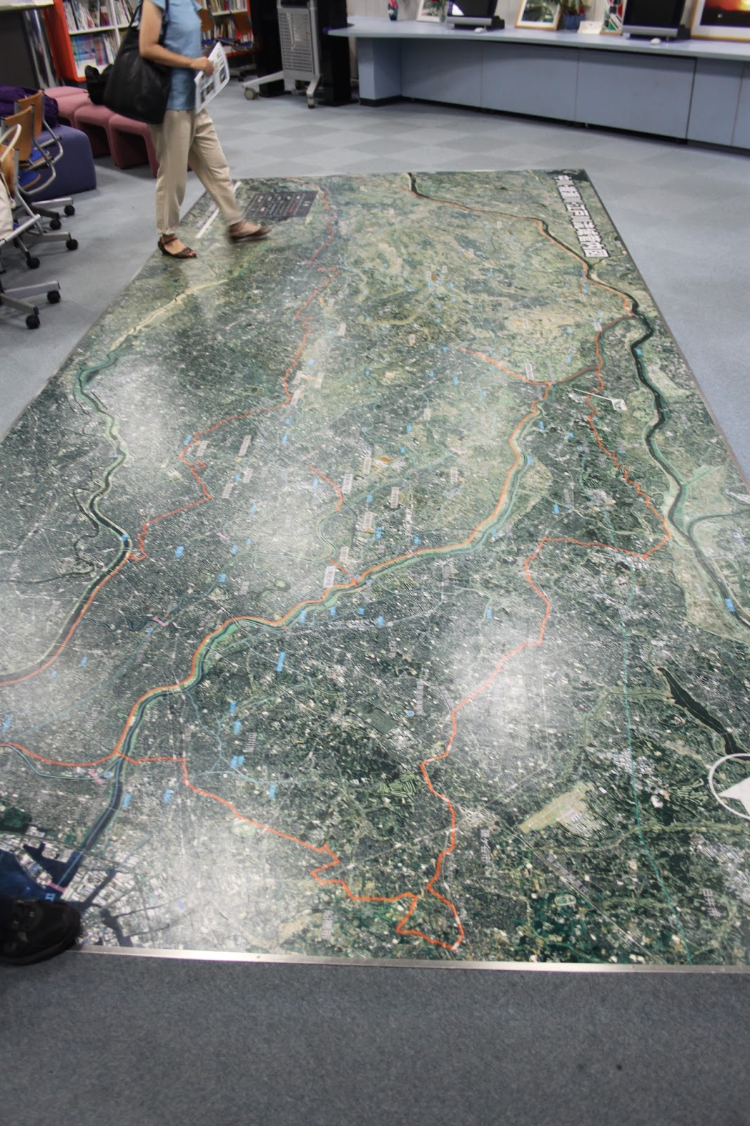
A better picture of the 3D elevation map, showing the bowl structure Tokyo is in and how elevated the river levees are compared to the surrounding landscape. 

Thursday, August 6, 2015

Visit to the Metropolitan Area Outer Underground Discharge Channel - part 1

Members of the ICHARM Risk Team joined with the students from the Tokyo University international summer course, who are learning to use the IFAS software at ICHARM this week, to visit the MAOUDC.

Already at the rest stop there were informative boards from the MLIT on places we visited before, including super levees, the statue in honor of the Dutch engineer Anthonie Rouwenhorst Mulder at the Nagareyama canal that connects the Tone and Edo rivers, and the discharge channel itself.


Here are links with more information from previous visits to the MAOUDC in August 2011 - August 2011 information - October 2011 and comparable underground storage facilities in November 2011.

Thursday, June 4, 2015

Deep earthquake

Last Saturday May 30 there was a truly deep earthquake, lasting quite long. It even gave 2 JMA earthquake reports, with increasing shindou to 5+ in some areas near Tokyo. According to the JMA it occurred at 590 km depth and had magnitude 8.5. Hopefully it encouraged people without survival packages to prepare.
The USGS however said it occurred at over 660 km depth and had a magnitude of 7.8. Intuitively it would make more sense to trust the JMA in this case, given how many advanced sensors there are in Japan, but why is the difference so great both in depth and magnitude? One publication states that 'Comparisons of real-time USGS epicenters and the Japan Meterological Agency (JMA) locations yield an average difference of 31 km (median 26 km)', however they only compared the accuracy of earthquakes shallower than 50 km.


Wednesday, September 10, 2014

Symposium "Policy studies on huge disasters"

Hosted at GRIPS, this symposium featured two keynote speeches by experts and a panel discussion with the following members:

  • Mr. Tetsuro Ito (Guest Professor, The University of Tokyo, Former Chief Cabinet Secretary for Crisis Management)
  • Mr. Takahito Iwata  (Director of Emergency Management Department, Shizuoka Prefectural Government)
  • Mr. Hajime Kagiya   (General Manager of Secretariat to the Assembly, Itabashi Ward Tokyo, Lecturer of Hosei University)
  • Prof. Keiko Tamura (Professor, Risk Management Office at Niigata University, Former member of Central Disaster Prevention Council)
  • Prof. Haruo Hayashi (Keynote speech 1 “Huge disasters and Improvement of resilience”)(Professor and Director, Research Center for Disaster Reduction Systems, Disaster Prevention Research Institute Kyoto University)
  • Prof. Naoshi Hirata (Keynote speech 2 “Generating mechanism of the huge earthquake disasters”) (Professor and Director, Earthquake Prediction Research Center at The University of Tokyo)

While the speeches were mainly technical and focused on the GEJET 2011 and predictions of similar future events in other areas of Japan, the panel discussion allowed for a small widening of topics, most importantly because it was possible to hand in questions to the panel members. There were simultaneous English-Japanese translations, so the following information may contain translation errors.

During the speeches the current predictions of a magnitude 8-9 earthquake in the Nankai trough (South East Japan) in the coming 30 years has 60-70% chance of occurring and showed over 300,000 deaths and a 30m tsunami in Shikoku. It is expected to cost 420 billion yen to reduce the estimated victims.


Tokyo still has a high probability of a magnitude 7+ earthquake. Here the main cause of death in projections is estimated to occur by electrical fires (70% of all projected deaths), meaning policies are focusing on how to stimulate private house owners to improve their houses as the government taxes are not sufficient to pay for all individual improvements. The fires are predicted to last 2 days as firefighters won't be able to reach all locations and electricity is thought to be out for one week. No police or ambulance can travel on the road for about a month due to obstructions. The Tokyo population is still increasing, not to births which are actually less than the amount of deaths, but due to immigration.

Equally interesting was the predictions of a magnitude 7-8 earthquake in Hokkaido and more northern island, which are Russian. Here it was mentioned that for some disputed islands, it is legally unclear who is responsible to save the inhabitants, though of course the Japanese government would make any effort to save those in need of rescue regardless of nationality.

During the panel discussion several topics were brushed. Mr. Iwata explained about Shizuoka, which already has many communities of 25% older adults where communities may lose their functions and become isolated during a disaster due to the mountainous area and easily blocked roads. It may even be that the area cannot receive relief. Should the communities aim at being fully self-resilient or be interdependent?

Residents who refused to evacuate when ordered to do so during the GEJET came in two categories, as explained by Prof. Tamura. The first wanted to claim damages, thought they understood the water level, and didn't acknowledge the tsunami. This could be addressed with by more education and adaptability. The second just couldn't pull themselves away from daily life, due to e.g. medication. This also requires more education during the normal routine, think about how you can be comfortable evacuating, and by keeping precious belonging nearby and ready to take with you.

Prof. Hirata commented on the possible eruption of mount Fuji, which was met with laughter. He said explosions are never sudden, there are several predicting phenomenon observed before eruptions. Some of those signs can be detected, and there are none right now. The magazine and press reports are without substance. During a magnitude 5 earthquake there were volcanic eruptions, so there will be a slightly higher chance for Fuji to erupt during a magnitude 9 earthquake. It could occur in the coming 50 years, a hazard map is available.
Mr. Iwata added that there is an evacuation plan coordinated between 3 prefectures which will be rehearsed next month and focuses on pyroclastic flow. One difficultly for the Nankai trough earthquake is that several eruptions are expected, roads will be damaged, and a small flow will already result in 200,000 evacuees, which is very difficult to manage.

Mr. Ito commented on local disaster drills. Always the same people visit the drills, but they would like to train specifically young mothers and students. There are not enough people to organize workshops on the community level. He also said that having a nice plan with pictures does not mean implementation is easy. For individuals, he recommends to make a disaster plan beforehand with your family based on the assumption that you are still alive and the shelters work. You should have water and food, and be fully prepared to protect yourself.

Mr. Ito also mentioned the relocation of (governmental functions of) Tokyo, which has been discussed many times and abandoned for various reasons. Can the ministries in Kasumigaseki survive? How can this, and the stock exchange, be maintained? Do the backup offices function? These questions remained unanswered.

All in all it was a highly educational discussion with comments from experts in all policy levels as well as from various parts of the country, each adding their valuable experiences.

Monday, September 1, 2014

Bousai no hi (Disaster Preparedness Day)

September 1 is disaster preparedness day in Japan. Most governmental organizations and schools will hold a disaster drill around this time. This is also a good time to check your own disaster preparedness kit for completeness and expiration dates, as well as check how your work/study place is prepared. Do you know the nearest emergency exit?

At GRIPS I saw that the lounge on the fifth floor, which is the floor that also has most of the student desks, has a large amount of helmets in boxes. Unfortunately this means the helmets cannot be used during an emergency, as students would first have to go to the lounge, unpack the helmets, and fit them, before being able to protect their heads. If you get a helmet, keep it under your desk and make sure beforehand to adjust the straps so that it fits your head when you need it. If there is a major earthquake, you are likely to want immediate protection, not after 3-5 minutes.


While being under-prepared helmet wise, GRIPS does have warning signs on top of lockers to minimize  the amount of items that might fall on your head (now it is only these cardboard warning signs).


The Aeon supermarket was also promoting disaster preparedness and selling goods for survival packages at home.


In other news, the mame-shiba are now informing people about water pipes in the subways.


Monday, March 31, 2014

International Development Professional Training Program finished

The end of March coincided with the end of the IDPTP program in Tokyo. It was a blast, meeting so many enthusiastic students from different fields of study and organizations, all eager to learn more on current issues in international development.

And now I'm featured thrice on the website pictures, the center bottom one showing the TEPCO debate where I had to emulate the director of TEPCO. We had a great team and were convincing enough, according to the audience. As you can read in the voices of previous participants, I highly recommend this interactive program for boosting your skills while increasing your knowledge. I can only hope to find such programs in future positions, wherever I may end up. Moreover, I can only hope to meet such great participants again!

Wednesday, July 4, 2012

Discovery's Building the Future

Discovery Channel had a series, Building the Future, also touching on the South-North Water Diversion Project in China, and the Edogawa Project in Japan. More information here.


South-North Water Diversion Project (Beijing, China) (#1)
Beijing, with a population that has swelled to nearly 15 million people, is struggling with an increasingly dire water shortage worsened by 30 years of drought. The Chinese government's answer is the largest water diversion undertaking ever. First envisioned by Mao Zedong in the early 1950s but not begun until 2002, the project will transport 300 million gallons of water each day from the Yangtze River in southern China to the parched, populous north via three concrete rivers, each nearly 1,000 miles long. (The most difficult part of the project will be the western route, which will require construction on the Qinghai-Tibet Plateau, at 10,000 to 16,000 feet above sea level.) Plans call for the project to be completed by 2050 at a cost of $62 billion. But whether it will be enough to alleviate China's water woes is a difficult question. Experts say that even with the extra water, the Chinese capital will have to dramatically reduce average household water consumption just to keep up with population growth. Another problem: pollution from China's rapidly growing industrial sector threatens to make the diverted water unfit to drink.
Edogawa River Project (Tokyo, Japan) (#2)
With Tokyo in the path of as many as two dozen typhoons each year, the city and its 12 million inhabitants are continually endangered by flooding. The answer: one of the most massive pumping systems ever constructed. Begun in 1992, with completion scheduled for 2009, the $2 billion system includes a four-mile-long network of tunnels connected to an 83-foot-tall storage tank and a cathedral-like structure of 59 massive pillars. The system's powerful turbines can pump 200 tons of water into the Edogawa River each second. The system has become a Tokyo tourist attraction, and it also has been used by television and movie crews as an eerily dramatic backdrop.

Saturday, May 19, 2012

Field Trip to JMA

Today we visited the Tokyo main office of the Japanese Meteorological Agency, and afterwards join a delegation from Pakistan around the Tone river area.

Just like at JAXA, the public can get tours at the JMA to see the actual people at work with only a window between you and the employees. The lecture mainly involved the travel of information between satellites, JMA and the government/public.


In the afternoon we revisited many local MLIT branch offices, and even the Watarase river basin.