20,000 participants gathered today for the Tone river drills. Although the majority consisted of suibo (flood fighting), firefighting and military personnel, this drill is also open to the public. From arrival to departure, everything was catered to.
After arriving on site, guided by about 20 traffic aides, a new bus transported us from the parking lot to the actual drill site. Many vans and stands offered demonstrations, such as knot tying, first aid, typhoon or earthquake simulations, oil absorbing products and inflatable dams. Awareness was also created by one stand where you could put on special glasses that make you experience what a color blind person would see when watching the average map of dangerous sites in green, yellow and red. We walked around between strategically based toilets and five mascots to get to our spot.
The main event was to sit in tents and watch the actual drills unfold (on the screen) in front of us. First of all we enjoyed an opening ceremony with taiko drums, and several speeches in Japanese. The different divisions responsible for flood fighting then reported for duty one by one. Next different drills were enacted, such as over topping and water seepage through the subsoil of the levee. A big difference with the Netherlands, aside from the military precision everyone executes, is the amount of bamboo used in emergency measures. Just as we were set to leave, the military rescue of people on rafts in the river started.
Flood disaster management practices and vulnerability in Japan, the Netherlands and elsewhere.
Sunday, May 20, 2012
Saturday, May 19, 2012
Field Trip to JMA
Today we visited the Tokyo main office of the Japanese Meteorological Agency, and afterwards join a delegation from Pakistan around the Tone river area.
Just like at JAXA, the public can get tours at the JMA to see the actual people at work with only a window between you and the employees. The lecture mainly involved the travel of information between satellites, JMA and the government/public.
In the afternoon we revisited many local MLIT branch offices, and even the Watarase river basin.
Labels:
Japan,
Preparation,
Prevention,
River,
Storm,
Tokyo,
Water storage
Tuesday, May 8, 2012
Hojo Town Tornado Aftermath
Colleagues have taken pictures of the aftermath of the tornado in Hojo Town, at the North of Tsukuba municipality. The destruction is enormous. Below are images showing where Hojo town is in Japan, and a view of the tornado path. It still is hard to believe this is the same place we visited just three weeks back. Many former possessions are already stacked away as trash, and people are fixing their roofs. The Self Defense Force was also assessing damage. Even stone statues of the temples are broken and concrete power lines pushed into the ground.
Tsukuba City Homepage now also had information available in English:
The JMA is being cautious and have issued a warning, according to the mainichi: The weather agency cautioned that similar atmospheric conditions that gave rise to the tornados on Sunday could develop over a wide area between Thursday through Friday.
Tsukuba City Homepage now also had information available in English:
There was a Tornado in Tsukuba City on May 6th (12:45pm)(Updated May 7,2012)
- Evacuation Places
1) Oda elementary school
2) Tai elementary school - Where to dispose waste,rubbles, garbage, etc.
1) Tsukuba community center (South parking area)
■8:30am - 17:15pm (every day for the time being)- wood/timber, heat insulating material, concrete walls, roof tiles are acceptable.
2) Clean center
■weekdays 8:30am - 16:30pm, Sat 8:30am - 11:30am- burnable garbage, non-burnable garbage, home electric appliances are acceptable.
※Please bring the garbage directly to the Clean Center (Tsukuba Mimori 2339, Tel:029-867-1379)
- Traffic Information
Bus stops have changed around the Hojo area and around the Tsukuba community center.
The Japanese version of the website shows much more detailed information, including the following table (translated by Google Translate):
| Human suffering (human) | Dwelling damage (buildings) | ||||||
Dead
|
Missing person
| Injured |
Hojo district
| Daisuna district | Nishigoya district |
Yoshinuma district
| |
| Serious injury | Minor injury | ||||||
One
| Zero | Zero | 37 |
170 destroyed, 207 partially destroyed, 450 damaged part, a total of 827
(Some of them are also included non-residential buildings such as warehouses, barns)
| |||
Almost immediately after the event the emergency volunteer website started to organize volunteer activities (translated by Google Translate):
We will begin registering volunteers to affected areas at this time a tornado occurred in Tsukuba City on May 6. Future, you will be asked to go to activity according to the needs of subscribers from the victims. Asked to perform activities according to your needs, so you may not be able to ask their activities are registered, please understand. Contact Volunteer Center disaster ◆ Tsukuba Address: (place of study painting two school district town D32) 2530-2 Karima Tsukuba , Tsukuba City Hall second floor Phone :029 -883 -1370 ※ Registration time volunteers, 9:00 to 17:00 will be. Addition, if you know of anyone who made the request of the volunteer activities in Shakyo, we will join the (plan A natural disaster) insurance Shakyo volunteer activities at their own expense. In addition, households are limited to local areas and, unlike when the earthquake affected areas, many are not coming up still needs volunteers. In addition, the site is located at inconvenient traffic, crowded with a vehicle such as debris removal and restoration work, and had been suffering from traffic congestion. Volunteer coordination, so you will be a request from more activity in accordance with the circumstances and needs of victims of the disaster area, familiar with regional conditions, please register it understands.
The JMA is being cautious and have issued a warning, according to the mainichi: The weather agency cautioned that similar atmospheric conditions that gave rise to the tornados on Sunday could develop over a wide area between Thursday through Friday.
Sunday, May 6, 2012
Trip to Kokai and Kinu river
We are safe!
Today we returned from a trip to the Kokai and Kinu river. The news when we returned was that Tsukuba had been struck by a tornado. It actually struck the Hojo area North of Tsukuba, where we visited with professor Takeuchi earlier last month. It also caused a power outage, but we have full power here, so it's almost as if nothing happened. The Tsukuba city website is displaying which bus to take to evacuation centers in case you were living in the Hojo area. Over 400 houses are destroyed and 30 people are injured, some severely, and one boy has died. Tornadoes are rare, it is said.
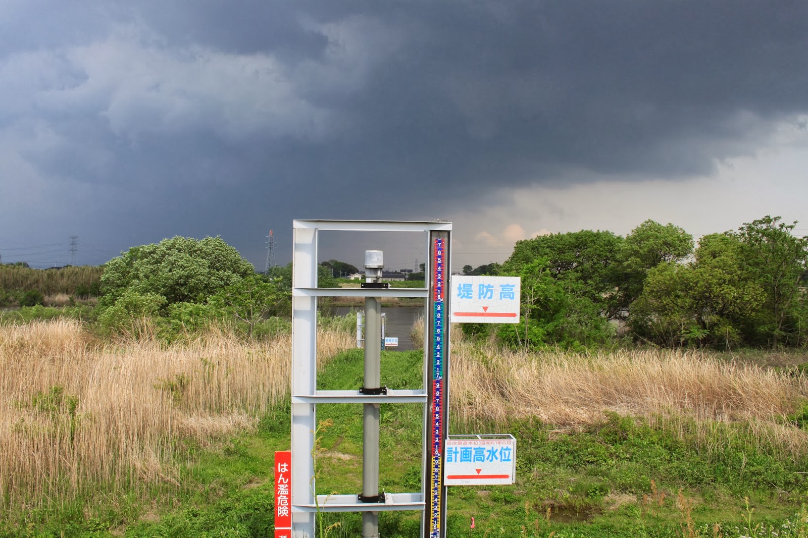
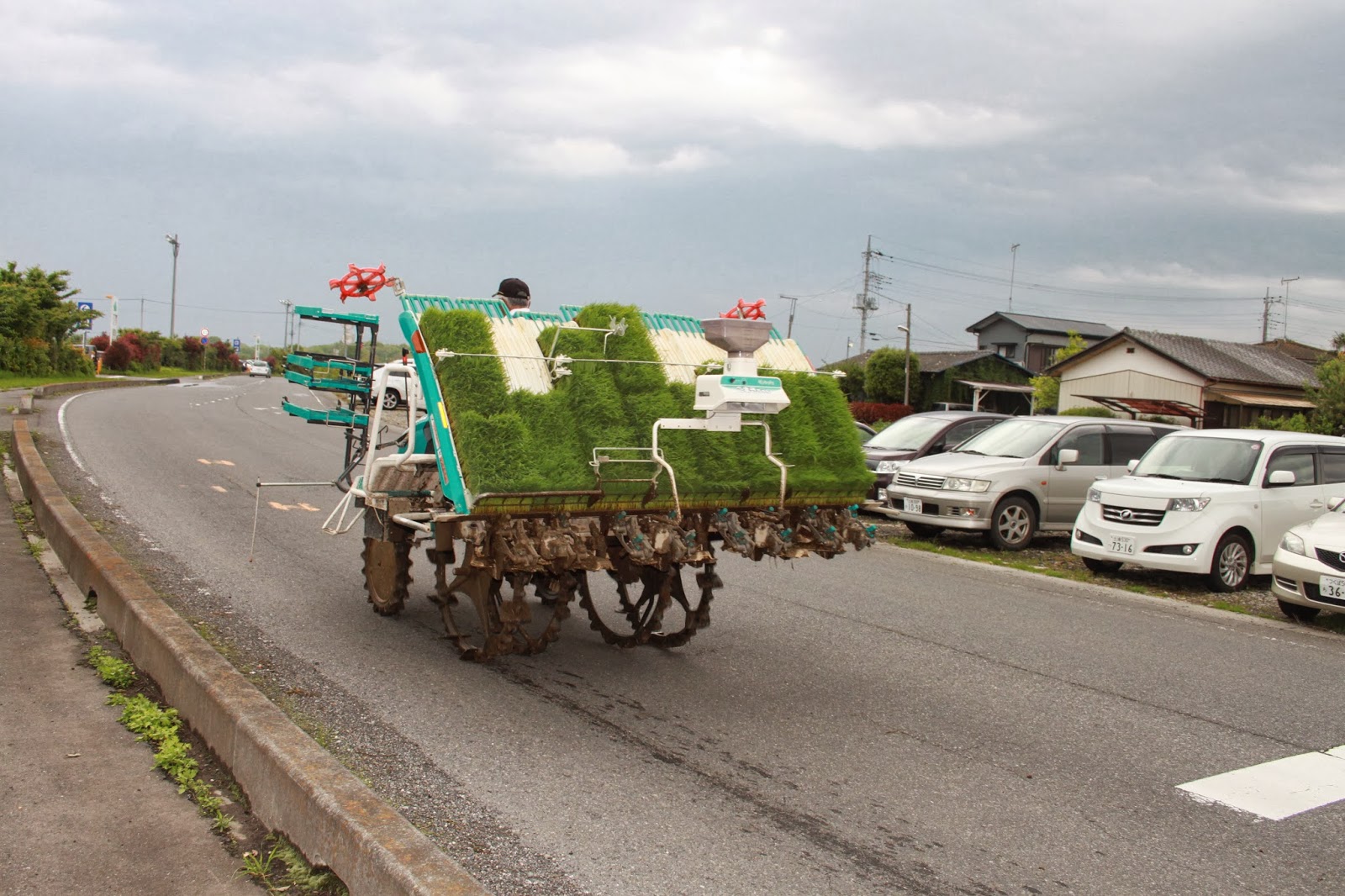
The pictures we took today show stormy skies. Having a holiday, many people were out on the river with jet skis or fishing equipment. At the Fukuoka weir, we nearly were blown off the weir into the water. This was about the time the tornado struck. We stopped at several water in- and outlets going North along the Kokai river. We ended up at the butterfly shaped insect museum, which also features fish and a gallery with pictures and images made from flower petals. At the Aeon shopping mall we saw an agricultural rice planting machine. The next day I heard there was a tornado in Tsuchiura last year, just 10 km South of Tsukuba. It doesn't sound quite so rare.
Today we returned from a trip to the Kokai and Kinu river. The news when we returned was that Tsukuba had been struck by a tornado. It actually struck the Hojo area North of Tsukuba, where we visited with professor Takeuchi earlier last month. It also caused a power outage, but we have full power here, so it's almost as if nothing happened. The Tsukuba city website is displaying which bus to take to evacuation centers in case you were living in the Hojo area. Over 400 houses are destroyed and 30 people are injured, some severely, and one boy has died. Tornadoes are rare, it is said.
The pictures we took today show stormy skies. Having a holiday, many people were out on the river with jet skis or fishing equipment. At the Fukuoka weir, we nearly were blown off the weir into the water. This was about the time the tornado struck. We stopped at several water in- and outlets going North along the Kokai river. We ended up at the butterfly shaped insect museum, which also features fish and a gallery with pictures and images made from flower petals. At the Aeon shopping mall we saw an agricultural rice planting machine. The next day I heard there was a tornado in Tsuchiura last year, just 10 km South of Tsukuba. It doesn't sound quite so rare.
Sunday, April 29, 2012
News in Japan - April
GEJET
Japan
Netherlands
Japan
Netherlands
Translation:
Today it is exactly 20 years ago since our country was hit by the most severe earthquake in recorded history. The quake took place on April 13, 1992, near Roermond (South of the Netherlands). The quake had a magnitude of ML = 5.8 on the Richter Scale. The quake occurred in the middle of the night and caused around 100 million euro in damages. Aftershocks occurred in an area of 100 km from Roermond. The quake was felt in the Czech Republic, Switzerland, France and England.
Asia
Labels:
Asia,
Earthquake,
Flood,
Japan,
Preparation,
Radiation,
Response,
Storm,
Tsunami
Friday, April 20, 2012
ICHARM Open Day
Today was ICHARM’s Open Day where we got a visit from high
school students.
This year’s program started with a welcome address by Prof. Kuniyoshi
Takeuchi, the Director of ICHARM. After this Dr. Yoganath Adikari and Dr. Dinar
Istiyanto presented on ‘Water and water-related issues’ and ‘Hazard, Risk and
Disaster’ respectively.
The next section called ‘Let’s learn and talk with Foreign researchers, PWRI supported Doctor
course students and JICA sponsored Master course students’ featured posters and
presenters from the countries Bangladesh, China, Ethiopia, Fiji, Indonesia, the
Netherlands, Nepal, Pakistan, the Philippines, Sri Lanka, Tunisia, and Vietnam.
During this section I presented a poster on the ‘History and Future of
Water Related Disasters in the Netherlands’ together with Babeth Bosma, our visiting bachelor internship student
from the Netherlands.
Sunday, April 15, 2012
Field Trip to Upper Sakura River Basin
Today we went on a trip with Takeuchi-sensei along the Northern part of the Sakura river. We saw Tsukuba mountain's Hojo ooike (big pond), visited the Amabikikannon and fed the peacocks, and went to the origin of the Sakura river as well as the Isobe Inamura jinja, which is the origin of Noh theater in this region and guards different Sakura tree species.
Hojo is a town in the North of the Tsukuba municipality, just South of its own little mountain. The Sakura river has not had many floods, but in 1986 the vicinity was affected. Hojo harbors these lakes mainly for fishing and irrigation rather than flood prevention, but it still helps. A little more upstream we encountered the same bridge we crossed when cycling to mount Tsukuba, and the inflatable dam. As opposed to the Netherlands, this dam is deflated during the flood season, and inflated to aid in, again, irrigation of the rice paddies. I was not so confident as professor Takeuchi, especially after noticing the air coming out of the dam suspiciously close to the drop point of the fishermen's hooks...
Our next stop was the Amabikikannon temple. Although the main theme of blessings here may be children and pregnancies, the name refers to pulling the water out of the sky (once more, for the harvest). The final temple, Sakuragawa Isobe Inamura Jinja, is said to be the origin of Noh theater in this region and is actually built around a stage where No was performed. It was possible to get a cleansing blessing while No theater music was playing. There is a total of 11 different sakura trees protected at this shrine, making it the best place for hanami. The differences between the trees can be very subtle or plain to see: different bark or petal colors or shapes, the amount of petals, fading color towards the end of the petals, one stamen transformed into a petal shape... it was definitely worthwhile to see all these differences. Here, we were fortunate enough to meet an employee of Sakuragawa city. He enthusiastically explained all our questions on floods in the Sakura river. He was even kind enough to guide us to the origin of the Sakura river. Nearby the shrine were an old Tsubaki tree and a holy pond, the poor water quality clarifying the issue of the untouchability of holy grounds.
Subscribe to:
Posts (Atom)