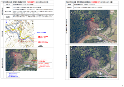
A first analysis of
the landslides East of Kumamoto city have become available. The photos are
courtesy of Kokusai Kogyo Co., Ltd. (国際航業株), taken on 16 April 2016;
the maps are freely available from the Japanese GSI. These
maps and photos show the earthquake damage points of concern (平成28年熊本地震災害で懸念される地震被害箇所), with a focus on river blocking by collapsed hill sides (河岸崩壊による河道閉塞箇所).
You can also view the before/after photos in a google earth type environment here, courtesy of the GSI. More pictures, videos and maps here. See also the 3D model of area #1 and this drone video of area #1.


No comments:
Post a Comment