The image below shows the flood safety norms in the Dutch Water Law, ranging from 1:250 years in the South East to 1:10,000 years in the West. However, these norms are theoretical.

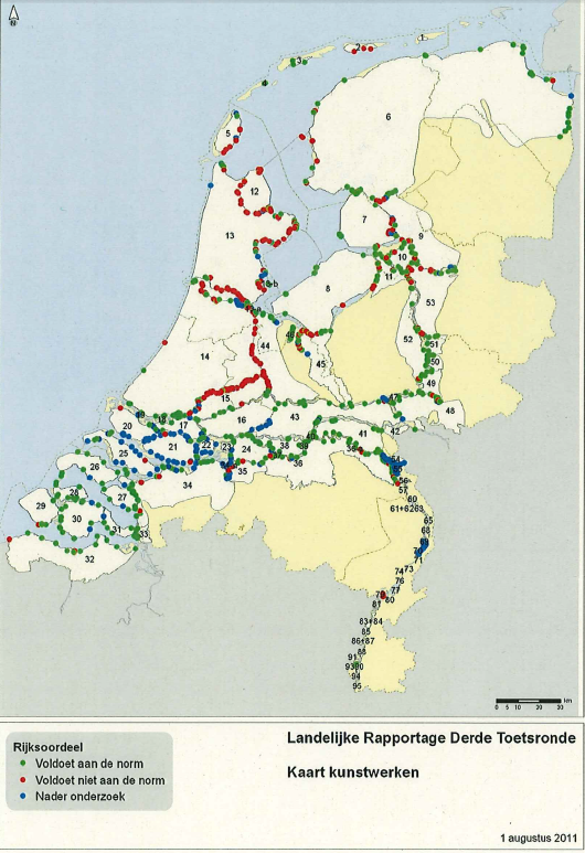
The third report of the status of levee and related infrastructure is downloadable (in Dutch) here. Results show that only 61% of the levees is confirmed to satisfy the norms. 33% does not satisfy the safety norms. In the images below, green means the levee of infrastructure object complies with the norms, red means it does not, and blue means additional research is required, which is scheduled to be finished at the end of this year.

Examples of infrastructure objects include: aquaduct, bridge, pumping station, sluice, tunnel, culvert (暗渠), weir (堰).
The table below shows different columns, starting with the provinces (Starting with Flevoland), the total number of km of dykes and levees in that province, the amount of km of levee that is within the norms (voldoet), the amount that is not (voldoet niet), and the amount of km that requires more research (nader onderzoek).

No comments:
Post a Comment