The day started out rather
drizzly, but the weir near Kasumigaura was fascinating nonetheless. We could
smell the salt ocean winds blowing across the water, as we were only 5 km from
the coast. At one of the 8 prefectural history museums, all the different types
of concrete seawall or river levee blocks were displayed. Which shape is your
favorite? They each have their own pros and cons: cost of material and
difficulty to make, effectiveness of shape in relation to displacement, and
fitting together with other shapes, be it similar or not.


Once inside, it was allowed to take some pictures, except in the most interesting room displaying how rice agriculture was practiced in the last 100 years. There were flat bottomed transportation boats, manual wooden pumping mechanisms, and pictures of children left in floating tubs while the people worked in the fields. It even featured a graph of the necessary water levels in the paddies during rice growth. There was a map displaying historic floods in the Tone river area.

Across the road of the museum is a famous iris garden, where we were just in time to catch a wedding. The bride was floating through the water, surrounded by flowers and random onlookers, wearing a beautiful kimono. The park also features one of the wooden water mills used to irrigate the paddy fields.
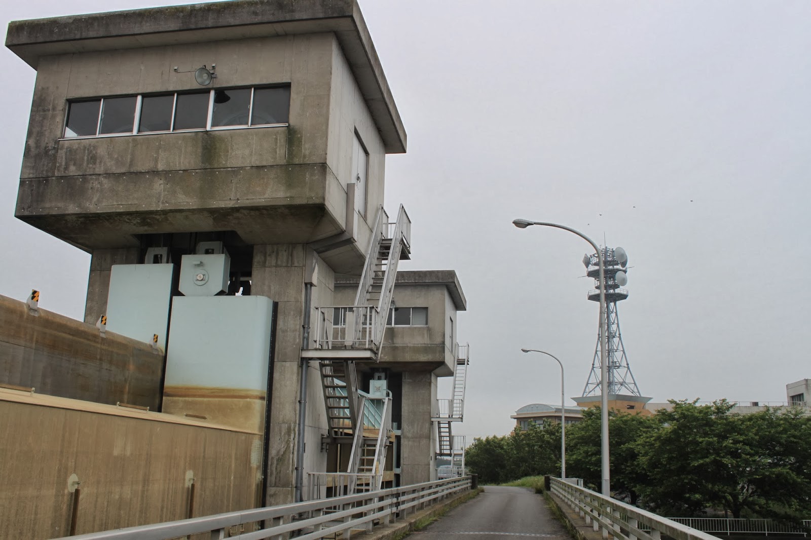
On the way to Sawara, the part of Katori city we were interested in visiting, we stumbled upon another lock gate. Influence from English engineers at the time are still clearly visible.
On the way to Sawara, the part of Katori city we were interested in visiting, we stumbled upon another lock gate. Influence from English engineers at the time are still clearly visible.


Sawara town has a lovely canal area with Edo period buildings, and a museum dedicated to one of the first cartographers of Japan, Ino Tadataka. After finishing his career, he started to travel around Japan and measure the coastline precisely using state of the art techniques of that time (around 1800). It took various expeditions to cover entire Japan, and his maps were remarkably accurate and also included an island that is now part of Russia. The very maps he created during his travels are displayed in the museum. Given the displacement following major earthquakes both in the horizontal and vertical direction (the last Tohoku disaster caused 1.2 meter downward and over 5 meter Westward displacement), it would be more fair to compare his maps to the geographical situation at the time, but of course his maps were the most accurate work of that time. The local shops have an incredible amount of crafts, as well as the visitor information center which is located in a former bank.


No comments:
Post a Comment